

1. Harz Witches Trail (Altenbrak to Thale)

- Where: Harz Mountains, Germany
- Starting Point: Altenbrak
- End Point: Thale
- Time Needed: 1-2 days
- Distance and Type: 18.7 kilometers point to point
- Difficulty: Moderate
- When to Hike: Spring, Summer, and Autumn
- Where to Stay: There are various accommodation options in both Altenbrak and Thale, including hotels, hostels, and guesthouses.
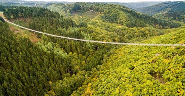
The Harz Witches Trail is a scenic hike through the Harz Mountains, an area steeped in folklore and legends of witches and magic. The trail starts in the small village of Altenbrak and winds its way through dense forests, past picturesque villages, and along the scenic Bode Gorge to the town of Thale.
Along the way, hikers can enjoy stunning views of the surrounding mountains and valleys, as well as several cultural highlights, including the historic Bodetal Information Centre, the Hexentanzplatz (Witches’ Dance Floor), and the Rosstrappe rock formation.
The trail is well-marked and relatively easy to follow, with some steep sections and rocky terrain. It is recommended to bring sturdy hiking shoes and a map or GPS device. The best time to hike the Harz Witches Trail is from spring to autumn, when the weather is mild, and the scenery is at its best.
2. Devil’s Wall Trail

- Where: Harz Mountains, Germany
- Starting Point: Blankenburg
- End Point: Thale
- Time Needed: 1-2 days.
- Distance and Type: 19 kilometers point to point
- Difficulty: Moderate
- When to Hike: The best time to hike the Teufelsmauerstieg is between April and October, when the weather is mild, and the trail is not covered in snow.
- Where to Stay: There are several accommodation options in Blankenburg and Thale, including hotels, guesthouses, and campsites.
The Teufelsmauerstieg, or Devil’s Wall Trail, is a scenic hike that takes you along the Teufelsmauer rock formation, which rises up to 30 meters (98 feet) in places. The trail passes through beautiful forests and meadows, with stunning views of the surrounding landscape. Along the way, hikers can also explore several historic sites, including the ruins of the Regenstein Castle and the Hexentanzplatz, or Witches’ Dance Floor. This hike is perfect for those looking for a moderate day hike in the Harz Mountains.
3. Rennsteig (Masserberg to Oberhof)

- Where: Thuringian Forest, Germany
- Starting Point: Masserberg
- End Point: Oberhof
- Time Needed: 2-3 days.
- Distance and Type: 43.5 kilometers point to point
- Difficulty: Moderate
- When to Hike: Late spring to early autumn
- Where to Stay: There are several options for accommodation along the trail including hotels, inns, and guesthouses.
The Rennsteig is a historic trail that stretches 170 km across the Thuringian Forest in central Germany. This section of the trail runs from Masserberg to Oberhof, covering 43.5 km of beautiful mountainous terrain. The trail passes through dense forests, over rolling hills, and along mountain ridges with stunning views of the surrounding landscape. Along the way, hikers will pass through charming towns and villages with traditional German architecture and culture. The trail is well-marked and maintained, making it a popular destination for hikers of all levels. With moderate difficulty, it is perfect for those looking for a challenging yet rewarding multi-day hike.

4. Saar-Hunsrück Steig (Idar-Oberstein to Morbach)

- Where: Saarland and Rhineland-Palatinate, Germany
- Starting point: Idar-Oberstein
- End point: Morbach
- Time needed: 1-2 days.
- Distance and Type: 25 km point to point
- Difficulty: Moderate
- When to hike: The best time to hike the Saar-Hunsrück Steig is between April and October. However, it is recommended to avoid hiking during the peak summer months due to the high temperatures and potential for crowds.
- Where to stay: There are various accommodations available along the trail, including hotels, guesthouses, and campsites. Some popular options include NaturCampingpark GmbH, Naturerlebnisdorf Strotzbüsch, and Hotel Steuer.
The Saar-Hunsrück Steig is a beautiful hiking trail that runs through the Saar-Hunsrück Nature Park in western Germany. This section of the trail starts in the town of Idar-Oberstein and ends in Morbach, covering a distance of around 25 km. The trail is well-marked and offers hikers stunning views of the surrounding countryside, including lush forests, picturesque valleys, and rolling hills.
The trail begins in Idar-Oberstein, a historic town known for its gemstone industry. From there, it heads eastward through the forests of the Idarwald and the Kellenbachtal valley before ascending the Erbeskopf, the highest peak in the region. Hikers can enjoy panoramic views of the surrounding area from the summit before descending into the Morbach valley and ending their hike in the town of Morbach.
5. Kellerwaldsteig (Netze to Jesberg)
- Where: Kellerwald-Edersee National Park, Germany
- Starting point: Netze
- End point: Jesberg
- Time needed: 1-2 days.
- Distance and Type: 19 kilometers point to point
- Difficulty: Moderate-Difficult
- When to Hike: The best time to hike the Kellerwaldsteig is from April to October, although it can be hiked year-round.
- Where to stay: There are several accommodation options available along the trail, including guesthouses, inns, and campsites. Some popular options include Pension Haus Waldfrieden, Hotel Hassia, and Campingplatz Edersee.
The Kellerwaldsteig is a circular trail that takes you through the beautiful landscape of the Kellerwald-Edersee National Park. The trail is well marked and takes you through dense forests, past crystal-clear streams, and over rolling hills with stunning views.
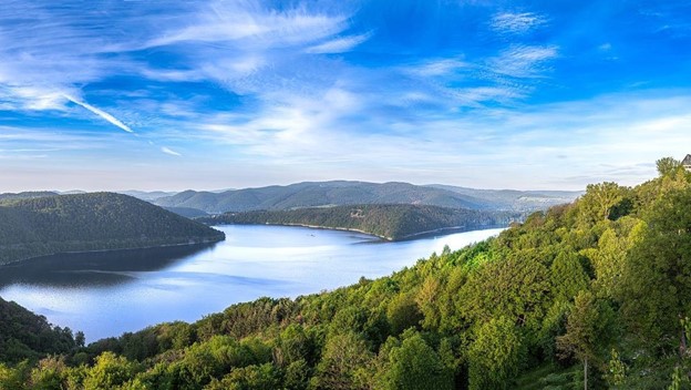
Starting in Netze, the trail leads you through the heart of the national park, passing through the small village of Basdorf and the historic town of Frankenberg. You will also have the opportunity to explore the Edersee, one of Germany’s largest reservoirs, and enjoy stunning views from the dam.
The trail is relatively moderate in difficulty, with some steep climbs and descents, but overall it is suitable for hikers of all levels. There are also plenty of places to stay along the way, including campsites, guesthouses, and hotels.

6. Barbarossaweg (Bad Frankenhausen to Kyffhäuser)
- Where: States of Thuringia and Saxony-Anhalt, Germany
- Starting Point: Bad Frankenhausen
- End Point: Kyffhäuser
- Time Needed: 1-2 days
- Distance and type: 16.7 km point to point
- Difficulty: Moderate
- When to Hike: The Barbarossaweg can be hiked year-round, but it is best to avoid the hottestsummer months.
- Where to Stay: There are several accommodations available in Bad Frankenhausen and Kyffhäuser.
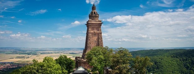
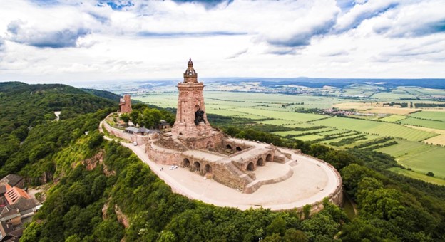
The Barbarossaweg is a historic trail named after Emperor Frederick Barbarossa. The trail begins in the town of Bad Frankenhausen and winds its way through the scenic Kyffhäuser Mountains. Along the way, hikers will pass by several historic sites, including the 19th-century Kyffhäuser Monument, which offers stunning panoramic views of the surrounding landscape. The trail is moderately difficult and includes some steep ascents and descents, but hikers will be rewarded with breathtaking views and a glimpse into Germany’s rich history.
7. Pfälzer Weinsteig (Bockenheim to Bad Dürkheim)
- Where: Palatinate region, Germany
- Starting Point: Bockenheim
- End Point: Bad Dürkheim
- Time Needed: 1-2 days
- Distance and Type: 17.5 kilometers point to point
- Difficulty: Moderate-Difficult
- When to Hike: The best time to hike the Pfälzer Weinsteig is from April to October, when the weather is mild, and the vineyards are in bloom.
- Where to Stay: There are several towns and villages along the Pfälzer Weinsteig where you can find accommodation, including Bockenheim, Kindenheim, and Bad Dürkheim.
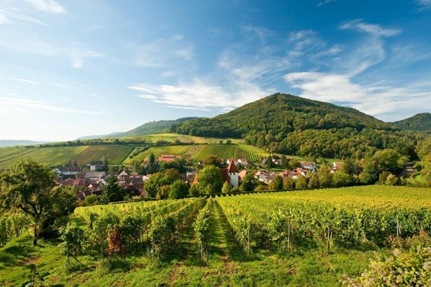
The Pfälzer Weinsteig is a scenic hiking trail that winds through the vineyards and hills of the Palatinate wine region. The trail starts in the town of Bockenheim and follows a well-marked path through the countryside, passing by historic villages and wineries along the way. The highlight of the hike is the panoramic views of the Rhine Valley and the surrounding vineyards. The trail ends in the spa town of Bad Dürkheim, where hikers can enjoy the local wine and thermal baths. Overall, the Pfälzer Weinsteig is a great option for hikers who want to experience the beauty and culture of the Palatinate region.
8. Rothaarsteig (Dillenburg to Hilchenbach)
- Where: Germany, located in the Rothaar Mountains in the states of North Rhine-Westphalia, Hesse, and Rhineland-Palatinate.
- Starting Point: Dillenburg
- End Point: Hilchenbach
- Time Needed: 1-2 days
- Distance and Type: 36 kilometers point to point
- Difficulty: Moderate-Difficult
- When to Hike: The Rothaarsteig can be hiked year-round, but the best time to go is from late spring to early autumn when the weather is milder and the scenery is at its best.
- Where to Stay: There are several places to stay along the route, including hotels, guesthouses, and campsites. Some popular options include Hotel Dillenburg, Hotel Lahnblick, and Campingplatz Panorama.
The Rothaarsteig is a stunning hiking trail that winds through the beautiful landscape of the Rothaar Mountains. The section from Dillenburg to Hilchenbach is particularly scenic, featuring panoramic views of the surrounding valleys, forests, and mountains. Along the way, hikers will pass through charming villages and historic towns, including the picturesque village of Manderbach and the spa town of Bad Laasphe. The trail also takes hikers through the impressive granite rock formations of the Breitenbachklamm gorge and past the historic castle ruins of Ginsburg. Overall, the Rothaarsteig is a must-see destination for nature lovers and hikers looking for a challenging yet rewarding adventure.
9. Hermannsweg (Tecklenburg to Bad Rothenfelde)

- Where: Teutoburg Forest region, State of North Rhine-Westphalia, Germany
- Starting point: Tecklenburg
- End point: Bad Rothenfelde
- Time needed: 1-2 days.
- Distance and type: 27 kilometers point to point
- Difficulty: Moderate-Difficult
- When to hike: The Hermannsweg trail can be hiked year-round, but the best time to hike is in the spring or fall when the weather is mild.
- Where to stay: There are various accommodation options available along the trail, including campsites, guesthouses, and hotels. Some popular options near the Tecklenburg starting point include Hotel Bismarckhöhe and Gasthaus und Pension Steffen, while near the Bad Rothenfelde endpoint; you could stay at Hotel Zur Post or Hotel Dreyer Garni.
The Hermannsweg trail is one of the most famous hiking trails in Germany, known for its stunning views of the Teutoburg Forest and the surrounding countryside. The section from Tecklenburg to Bad Rothenfelde is particularly scenic, passing through dense forests, open fields, and rolling hills. Along the way, hikers will also encounter several historical landmarks, including the Hermannsdenkmal monument, which commemorates the Battle of the Teutoburg Forest. The trail is well-marked with signposts and offers several rest areas and picnic spots, making it a great option for a day hike or a multi-day adventure
10. Eifel Traumpfad (Ettringen to Mayen)
- Where: Ettringen to Mayen, Eifel region, Germany
- Starting Point: Ettringen, Germany
- End Point: Mayen, Germany
- Time Needed: 1-2 Days
- Distance and Type: 17 kilometers point to point
- Difficulty: Moderate
- When to hike: late spring to early autumn (May to October) when the weather is mild and the scenery is at its best
- Where to Stay: There are several accommodation options in the area, including hotels, bed and breakfasts, and campsites. Mayen is a good option for overnight stay as it is the endpoint of the trail and has a variety of lodging options.
The Eifel Traumpfad is a beautiful hiking trail that offers stunning views of the Eifel region in Germany. The trail starts in Ettringen, a small village known for its volcanic rock formations and mineral springs. From there, the trail leads hikers through dense forests, past crystal-clear streams, and up steep hillsides.
As hikers make their way towards the endpoint in Mayen, they will encounter historic ruins, charming villages, and panoramic vistas of the surrounding countryside. The trail ends in Mayen, a historic town with a rich cultural heritage and many attractions to explore.
Overall, the Eifel Traumpfad is a challenging but rewarding hike that highlights the natural beauty of the Eifel region. Hikers can enjoy a variety of landscapes and experiences along the way, and the trail is suitable for both experienced and novice hikers.
