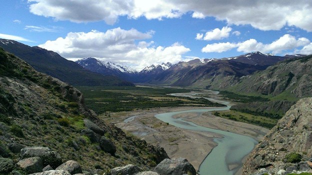
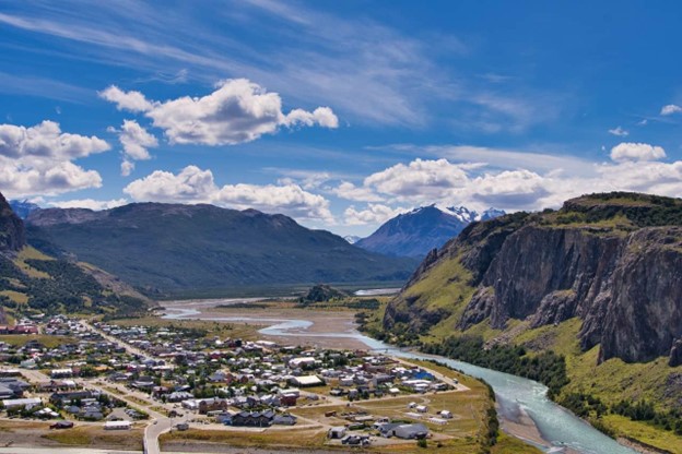
1. Laguna de Los Tres Hike (Fitz Roy)

- Where: El Chalten, Argentina
- Starting point: El Chalten town or Hosteria El Pilar
- End point: Laguna de Los Tres
- Time needed: 8-10 hours.
- Distance and Type: 24 kilometers circuit
- Difficulty: Difficult
- When to Hike: Best time is from October to April (summer in the southern hemisphere), but it can be done year-round with appropriate gear and experience.
- Where to stay: El Chalten town or camping in the park
The hike to Laguna de Los Tres is one of the most popular in El Chalten and offers stunning views of Mount Fitz Roy and the surrounding peaks. The trail starts from El Chalten town or Hosteria El Pilar and follows a well-marked path through forests, streams, and moraines. The last section of the trail is steep and rocky, but the view at the end is worth the effort. At Laguna de Los Tres, hikers can admire the turquoise lake and the panoramic view of Fitz Roy and its glaciers. It is a challenging hike, but the scenery and the sense of accomplishment make it a must-do for hikers visiting El Chalten.

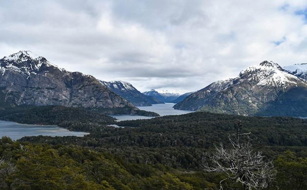
2. Cerro Catedral Hike
- Where: Bariloche, Argentina
- Starting point: Base of Cerro Catedral
- End point: Summit of Cerro Catedral
- Time needed: 4-6 hours.
- Distance and Type: 12 kilometers circuit
- Difficulty: Moderate-Difficult
- When to Hike: November to April (summer)
- Where to stay: Bariloche or nearby villages such as Villa Catedral or San Carlos de Bariloche
The Cerro Catedral hike is one of the most popular hikes in Bariloche, offering stunning views of the surrounding mountains and Lake Nahuel Huapi. The trail starts at the base of the ski resort and winds through lush forests before reaching the exposed rock faces and scree slopes of the upper mountain. The final push to the summit involves some scrambling over boulders and loose rock, but the views from the top are worth the effort. Along the way, hikers can spot a variety of wildlife, including condors, eagles, and guanacos.
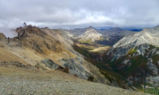
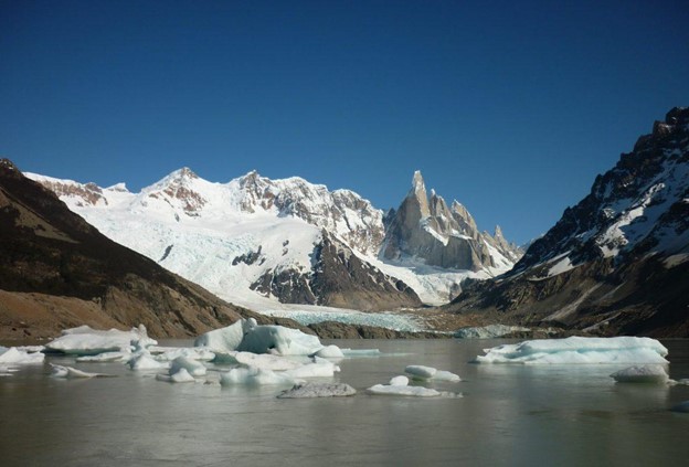
3. Laguna Torre Hike
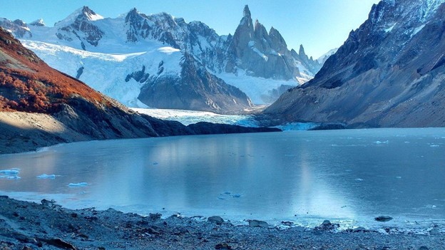
- Where: Los Glaciares National Park, Argentina
- Starting point: El Chaltén, Argentina
- End point: Laguna Torre
- Time needed: 6-8 hours.
- Distance and Type: 20 km circuit
- Difficulty: Moderate
- When to Hike: Best from November to April, but can be done year-round (weather dependent)
- Where to stay: El Chaltén offers various accommodations options.
The Laguna Torre hike is a popular trail in Los Glaciares National Park that leads to a stunning glacier-fed lake. The trail offers views of the Fitz Roy Massif and several hanging glaciers along the way. The hike is moderate in difficulty, with some steep uphill sections and rocky terrain. Hikers can also spot local wildlife, such as Andean condors and guanacos. The trailhead is in El Chaltén, a charming town known for its proximity to the national park and outdoor activities.
4. Cerro Llao Llao Hike
- Where: Bariloche, Argentina
- Starting Point: Llao Llao Hotel
- End Point: Summit of Cerro Llao Llao
- Time Needed: 4-5 hours.
- Distance and Type: 8 kilometers circuit
- Difficulty: Moderate-Difficult
- When to Hike: The best time to hike is during the summer months (December-February) when the weather is mild, and the days are longer.
- Where to Stay: The Llao Llao Hotel is a great option for those who want to be close to the starting point of the hike. There are also many other accommodation options in Bariloche.
The Cerro Llao Llao hike offers stunning views of the Nahuel Huapi and Moreno Lakes and the surrounding Andes Mountains. The trail starts at the Llao Llao Hotel and winds its way through a forest before reaching a steep climb to the summit. The final ascent to the summit is challenging and requires some scrambling over rocks, but the views from the top are worth it. It is important to note that the trail can be steep and slippery in places, so proper footwear is essential.

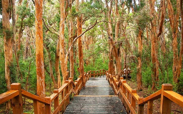
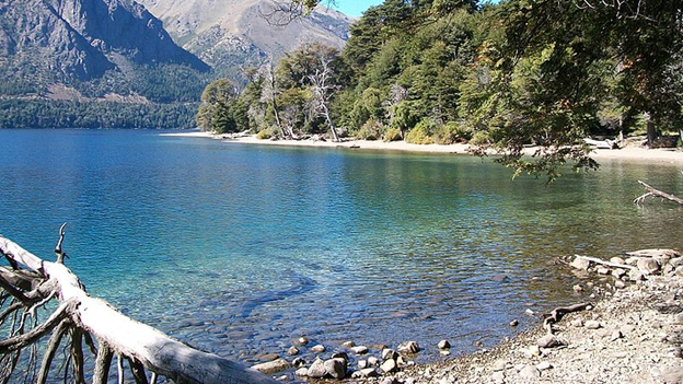
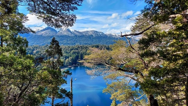
5. Bosque de los Arrayanes Hike
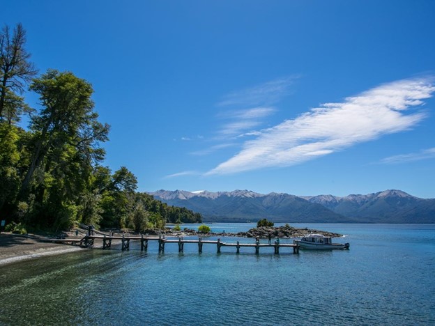
- Where: Bariloche, Patagonia, Argentina
- Starting point: Villa la Angostura
- End point: Arrayanes Forest
- Time needed: 4-5 hours.
- Distance and Type: 12 kilometers circuit
- Difficulty: Easy-Moderate
- When to Hike: Year-round (except in winter when there is snow and ice)
- Where to stay: Villa la Angostura or Bariloche
The Bosque de los Arrayanes Hike takes you through a beautiful forest of unique Arrayan trees, which are only found in this region of the world. The trail starts in Villa la Angostura and follows the shores of Lake Nahuel Huapi for a while before entering the forest. The trees are known for their cinnamon-colored bark, which peels off in thin, delicate layers. The trail is well-marked and easy to follow, with some moderate uphill sections. The end point of the hike is a boardwalk that winds through the forest, offering stunning views of the surrounding mountains and lake. It’s a peaceful and scenic hike, perfect for a day trip from Bariloche.
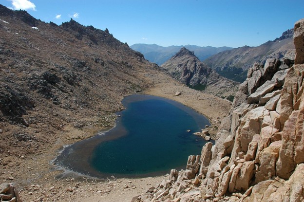
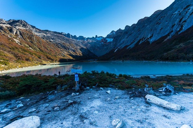
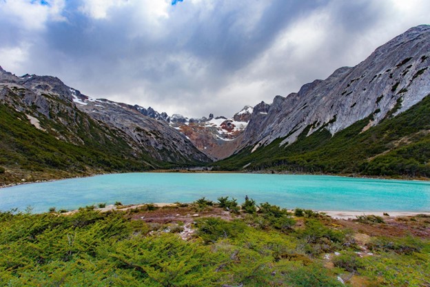
6. Laguna Esmeralda Hike
- Where: Ushuaia, Tierra del Fuego, Argentina
- Starting point: Ushuaia city or nearby campgrounds
- End point: Laguna Esmeralda (Emerald Lagoon)
- Time needed: 4-5 hours.
- Distance and Type: 10 kilometers circuit
- Difficulty: Moderate
- When to Hike: October to April (summer months)
- Where to stay: Ushuaia or nearby campgrounds
The Laguna Esmeralda Hike takes you through a beautiful valley surrounded by snow-capped mountains, passing through forests and crossing small streams before arriving at the stunning Emerald Lagoon. The lagoon is a turquoise-colored glacial lake that is fed by the surrounding glaciers. The trail is well-marked and moderately difficult, with some steep uphill sections and uneven terrain. It’s a popular day hike from Ushuaia and offers some of the most breathtaking scenery in Tierra del Fuego. Camping is also possible in the area, for those who want to spend more time in the wilderness.
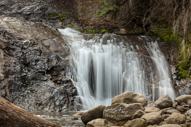
7. Cascada de los Duendes Hike
- Where: Bariloche, Patagonia, Argentina
- Starting point: Pampa Linda
- End point: Cascada de los Duendes (Waterfall of the Elves)
- Time needed: 2-3 hours.
- Distance and Type: 5 km (3.1 miles)
- Difficulty: Easy-Moderate
- When to Hike: Year-round (except in winter when there is snow and ice)
- Where to stay: Bariloche or nearby campgrounds
The Cascada de los Duendes Hike takes you through a beautiful forest and along the Manso River to a stunning waterfall. The trail is well-marked and relatively easy, with some uphill sections and uneven terrain. The waterfall is a hidden gem, tucked away in the forest and surrounded by rocks and lush vegetation. The trail can be hiked year-round, although it may be icy in the winter months. It’s a great hike for families and those who want a shorter, easier hike with a beautiful payoff at the end. Camping is also possible in the area, for those who want to spend more time in the wilderness.
8. Sendero de los Arrayanes Hike
- Where: Villa La Angostura, Patagonia, Argentina
- Starting point: Puerto Manzano or Bahía Brava
- End point: Arrayanes Forest
- Time needed: 2-3 hours.
- Distance and Type: 12 kilometers circuit
- Difficulty: Easy
- When to Hike: Year-round.
- Where to stay: Villa La Angostura or nearby campgrounds
The Sendero de los Arrayanes Hike takes you along the shores of Lake Nahuel Huapi to a beautiful forest of unique Arrayan trees. The trail is well-marked and easy, with only a few uphill sections. The trees are known for their cinnamon-colored bark, which peels off in thin, delicate layers. The end point of the hike is a boardwalk that winds through the forest, offering stunning views of the surrounding mountains and lake. It’s a peaceful and scenic hike, perfect for a day trip from Villa La Angostura. Camping is also possible in the area, for those who want to spend more time in the wilderness.

9. Mirador del Condor Hike
- Where: El Chaltén, Patagonia, Argentina
- Starting point: El Chaltén town
- End point: Mirador del Condor (Condor Viewpoint)
- Time needed: 3-4 hours.
- Distance and Type: 9 kilometers circuit
- Difficulty: Moderate
- When to Hike: October to April (summer months)
- Where to stay: El Chaltén or nearby campgrounds
The Mirador del Condor Hike takes you through the scenic Rio de las Vueltas valley to a lookout point where you can spot Andean condors soaring above the mountains. The trail is well-marked but can be steep and rocky in some sections, making it moderately difficult. The viewpoint offers stunning views of the Fitz Roy and Torre Mountain ranges, as well as the valley below. It’s a popular day hike from El Chaltén and a great opportunity to see some of Patagonia’s unique wildlife. Camping is also possible in the area, for those who want to spend more time in the wilderness.
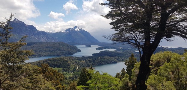
10. Cerro Campanario Hike
- Where: Bariloche, Patagonia, Argentina
- Starting point: Base of Cerro Campanario
- End point: Summit of Cerro Campanario
- Time needed: 2-3 hours.
- Distance and Type: 3 kilometers circuit
- Difficulty: Easy-Moderate
- When to Hike: Year-round.
- Where to stay: Bariloche or nearby campgrounds
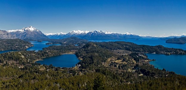
The Cerro Campanario Hike takes you up a steep trail to the summit of Cerro Campanario, one of the most famous viewpoints in the region. The trail is well-marked but can be steep and rocky in some sections, making it moderately difficult. The summit offers panoramic views of the surrounding lakes, mountains, and forests, including views of Bariloche and Nahuel Huapi Lake. It’s a popular day hike from Bariloche and a great opportunity to see some of the area’s stunning scenery. The hike can be done year-round, although the views may be obstructed by clouds or fog on cloudy days. Camping is also possible in the area, for those who want to spend more time in the wilderness.