
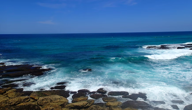
1. Bondi to Coogee Coastal Walk

- Where: New South Wales, Australia
- Starting point: Bondi Beach
- End point: Coogee Beach
- Distance and Type: 6 kilometers point to point.
- Difficulty: Easy
- When to Hike: Year-round, but spring and autumn (September to November and March to May) have milder temperatures.
- Where to Stay: There are several accommodation options in Bondi and Coogee, ranging from budget to luxury.
This scenic coastal walk takes you along the cliffs between Bondi and Coogee beaches, passing by stunning beaches, rock pools, and parks. The walk takes around 2-3 hours to complete, depending on how many stops you make along the way. Along the trail, you’ll also find several cafes and restaurants, making it a perfect day trip from Sydney.
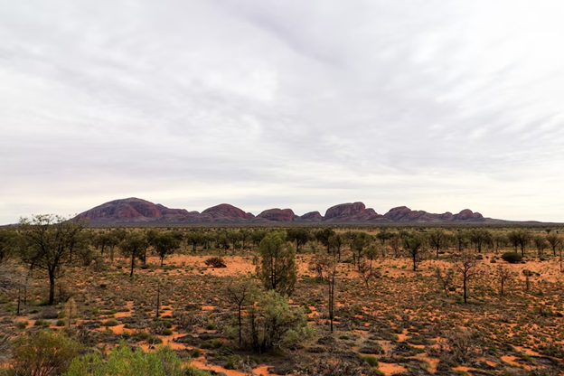
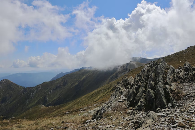
2. Valley of the Winds (Uluru-Kata Tjuta National Park)
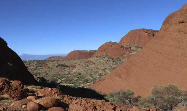
- Where: Northern Territory, Australia
- Starting point: Karingara Lookout car park
- End point: Karingara Lookout car park
- Time needed: 2-3 hours.
- Distance and Type: 7.4 kilometers circuit
- Difficulty: Moderate
- When to Hike: The best time to hike the Valley of the Winds is during the cooler months from April to September, as temperatures can reach over 40°C in the summer months. It’s also best to avoid hiking during the hottest parts of the day.
- Where to Stay: There are several accommodation options within the Uluru-Kata Tjuta National Park, including campgrounds, hotels, and resorts.
The Valley of the Winds hike takes you on a journey through the breathtaking Kata Tjuta (also known as the Olgas) rock formations. The hike is a challenging 7.4 km loop that takes you through narrow gorges and up steep inclines, but the stunning views of the surrounding landscapes make it well worth the effort. Along the way, you’ll see unique rock formations, native flora and fauna, and expansive views of the Australian outback.
3. Wineglass Bay and Hazards Beach Circuit
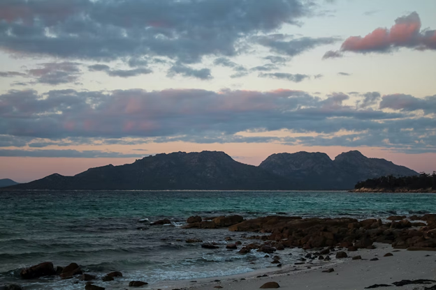
- Where: Freycinet National Park, Tasmania, Australia
- Starting Point: Wineglass Bay car park
- End Point: Same as starting point.
- Time Needed: 2.5-4 hours.
- Distance and Type: 11 kilometers circuit
- Difficulty: Moderate
- When to Hike: Year-round, but best from November to May.
- Where to Stay: There are camping and cabin options available in Freycinet National Park, as well as nearby accommodations in Coles Bay and Bicheno.
This scenic trail offers stunning views of Wineglass Bay and Hazards Beach. The trail starts with a steep climb up to a lookout over Wineglass Bay, then descends to Hazards Beach. From there, the trail continues along the coast, passing through forests and rocky outcrops before returning to the starting point. It is recommended to bring plenty of water, snacks, and sunscreen on this hike.
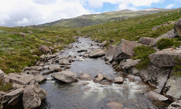
4. Mount Kosciuszko Summit Walk
- Where: Kosciuszko National Park, New South Wales, Australia
- Starting Point: Charlotte Pass or Thredbo
- End Point: Mount Kosciuszko Summit
- Time Needed: 4-5 hours.
- Distance and Type: 13 kilometers circuit
- Difficulty: Moderate
- When to Hike: December to March (summer season).
- Where to Stay: Jindabyne or Thredbo.
The Mount Kosciuszko Summit Walk is a must-do hike in Australia, as it leads to the highest point on the continent. The route takes hikers through alpine landscapes, across the Snowy River, and up to the summit of Mount Kosciuszko. There are two main starting points for the hike, Charlotte Pass and Thredbo, with the former being slightly shorter but steeper. The walk is well-marked and suitable for most fitness levels but can be challenging due to the altitude and weather conditions, so it is important to come prepared. Along the way, hikers will enjoy panoramic views of the surrounding peaks and valleys, as well as the chance to spot local wildlife such as kangaroos and wallabies.
5. The Pinnacle Lookout Walk
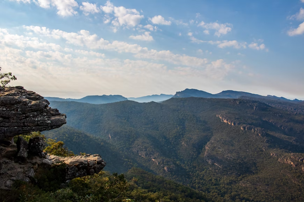
- Where: Grampians National Park, Victoria, Australia
- Starting Point: Sundial Carpark
- End Point: The Pinnacle lookout
- Time Needed: 1.5 – 2 hours.
- Distance and Type: 2.1 kilometers circuit
- Difficulty: Moderate
- When to Hike: Year-round, but the best time is from March to November.
- Where to Stay: Halls Gap is the closest town with accommodation options.
The Pinnacle Lookout Walk is a short but steep hike through stunning Grampians National Park. The trail takes you through rocky terrain and past towering sandstone cliffs, offering spectacular views of the surrounding landscape. The final ascent to the Pinnacle Lookout involves a series of steep steps, but the view from the top is worth it. On a clear day, you can see for miles over the stunning Grampians region.
6. Forts Walk
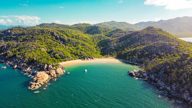
- Where: Magnetic Island, Queensland, Australia
- Starting point: Forts car park
- End point: Forts complex
- Time needed: 1-2 hours.
- Distance and Type: 4.2kilometers circuit
- Difficulty: Easy
- When to Hike: Year-round, but best from April to September
- Where to Stay: Magnetic Island has a range of accommodations, including hostels, camping, and resorts.
The Forts Walk on Magnetic Island takes hikers on a short but scenic loop trail that leads to World War II military fortifications and panoramic views of the island and the ocean. The trail winds through eucalyptus forest and rocky outcrops, and offers opportunities to spot wildlife such as koalas, rock wallabies, and a variety of bird species. The hike culminates at the Forts complex, where hikers can explore historic military structures and learn about the island’s role in defending Australia during the war.
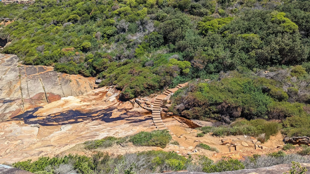
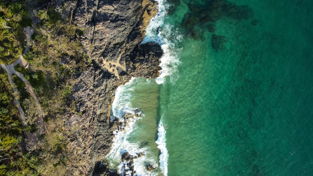
7. Royal National Park Coast Track

- Where: New South Wales, Australia
- Starting point: Bundeena or Otford, depending on direction of the hike.
- End point: Otford or Bundeena, depending on direction of the hike.
- Time needed: 4-6 hours.
- Distance and Type: 10 kilometers point to point.
- Difficulty: Moderate
- When to hike: Year-round, but best during spring (September-November) and autumn (March-May).
- Where to stay: Bundeena or nearby suburbs or camping within Royal National Park.
The Royal National Park Coast Track is a popular coastal walk that offers stunning ocean views, rock pools, beaches, and cliffs. The hike can be done in either direction, starting from either Bundeena or Otford. The trail is well-maintained and marked and includes some steep sections and stairs. The hike can be done as a day trip or as an overnight hike, with camping options available within the park.
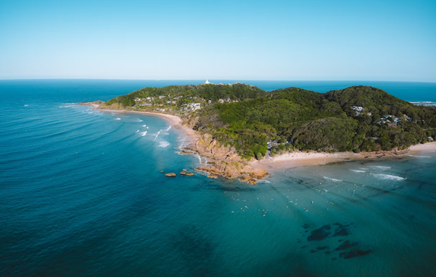
8. Cape Byron Walking Track

- Where: New South Wales, Australia
- Starting Point: Cape Byron Lighthouse
- End Point: Wategos Beach
- Time Needed: 2-3 hours.
- Distance and Type: 3.7 kilometers circuit
- Difficulty: Easy
- When to Hike: Year-round, but best in summer (December to February).
- Where to Stay: There are plenty of accommodation options in Byron Bay, such as hostels, hotels, and holiday apartments.
The Cape Byron Walking Track is a scenic coastal walk that offers stunning views of the ocean and the surrounding landscape. The track starts at the Cape Byron Lighthouse, one of the most iconic landmarks in the region, and takes you through rainforest, along cliff tops, and past secluded beaches. You’ll have the opportunity to spot dolphins, turtles, and whales (during migration season). The track is well-marked and easy to follow, making it suitable for all fitness levels. The highlight of the walk is the lookout at the easternmost point of the Australian mainland, where you can take in panoramic views of the ocean and the rugged coastline.
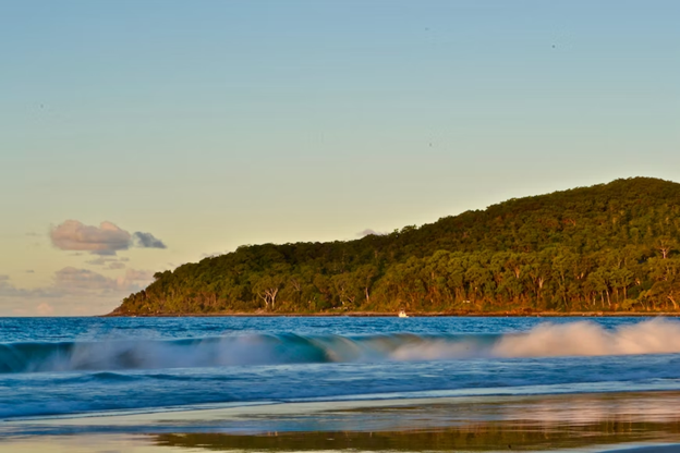
9. Noosa National Park Coastal Walk
- Where: Noosa National Park, Queensland, Australia
- Starting point: Noosa Heads Park Road Car Park
- End point: Noosa National Park Information Centre
- Time needed: 3-4 hours.
- Distance and Type: 10.8 kilometers circuit
- Difficulty: Easy-Moderate
- When to Hike: Year-round, but best to avoid peak summer months (December-February) due to high temperatures.
- Where to Stay: Noosa Heads, Sunshine Coast.
The Noosa National Park Coastal Walk is a beautiful, easy to moderate level hike that takes you along the coastline of the park. You’ll encounter stunning views of the ocean and coastline, as well as local wildlife such as koalas and dolphins. The trail is well-maintained and marked, and there are plenty of rest stops and picnic areas along the way. It’s a great way to spend a day in nature and get some exercise, while still being close to the amenities of Noosa Heads.
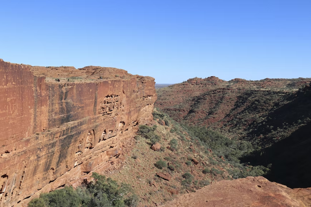
10. Kings Canyon Rim Walk (Watarrka National Park)

- Where: Northern Territory, Australia
- Starting point: The car park at Kings Canyon Resort.
- End point: The same as the starting point, the car park at Kings Canyon Resort.
- Time needed: 3-4 hours.
- Distance and Type: 6 kilometers circuit
- Difficulty: Moderate-Difficult.
- When to Hike: The best time to hike Kings Canyon Rim Walk is during the cooler months from April to September.
- Where to Stay: There are several options for accommodation near Kings Canyon, including the Kings Canyon Resort, Kings Creek Station, and the Kings Canyon Wilderness Lodge.
Kings Canyon Rim Walk is a popular hiking trail in Watarrka National Park that offers stunning views of the surrounding landscape. The trail is well-marked and starts with a steep climb up to the canyon rim, where hikers can enjoy breathtaking views of the canyon and the surrounding sandstone formations. The trail then follows the rim of the canyon, passing by several lookout points before descending back down to the starting point. The hike can be challenging, especially in the heat, but the views are well worth the effort.