
1. Corcovado National Park – Sirena Station Trail
- Where: Osa Peninsula, Costa Rica
- Starting Point: Carate
- End Point: Sirena Station
- Time Needed: Full day (8-10 hours).
- Distance and Type: 22 kilometers circuit
- Difficulty: Difficult
- When to Hike: December to April (dry season)
- Where to Stay: There are several lodges and accommodations near Carate, or camping is allowed at Sirena Station with a reservation.
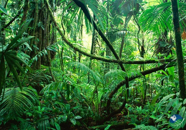
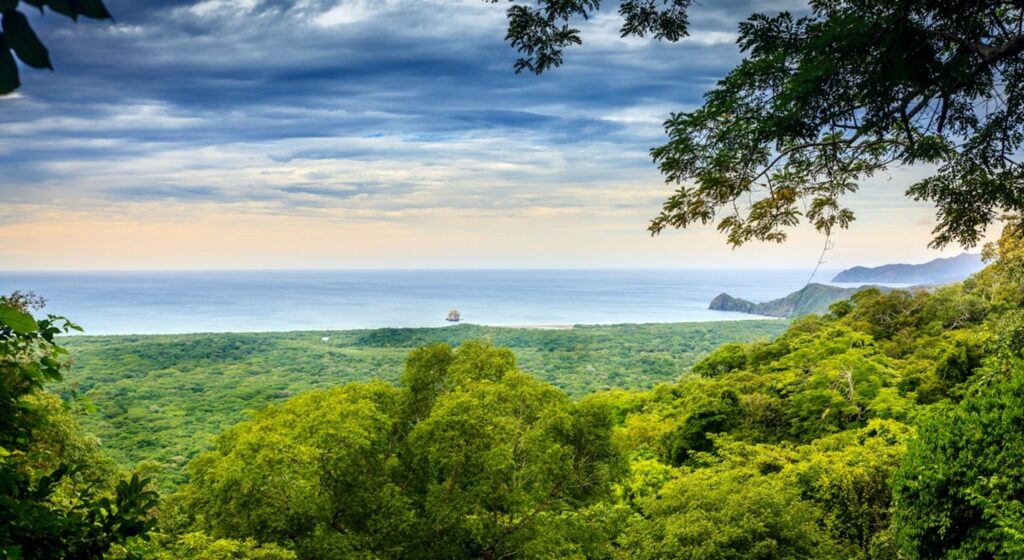
The Sirena Station Trail is one of the most popular hikes in Corcovado National Park, known for its biodiversity and stunning rainforest landscapes. The trail leads to Sirena Station, which is a research station and a great place for wildlife viewing. Hikers may see monkeys, sloths, tapirs, and a variety of bird species along the way. The hike can be challenging due to the humidity and heat, as well as the potential for muddy and slippery conditions. A guide is recommended for those without extensive hiking experience.
2. Monteverde Cloud Forest Reserve – Sendero Bosque Nuboso
- Where: Puntarenas, Costa Rica
- Starting Point: Monteverde Cloud Forest Reserve Visitor Center
- End Point: Monteverde Cloud Forest Reserve Visitor Center
- Time Needed: 2-3 hours.
- Distance and Type: 3.1 kilometers circuit
- Difficulty: Easy-Moderate
- When to Hike: Year-round
- Where to Stay: Monteverde Cloud Forest Reserve or nearby lodges
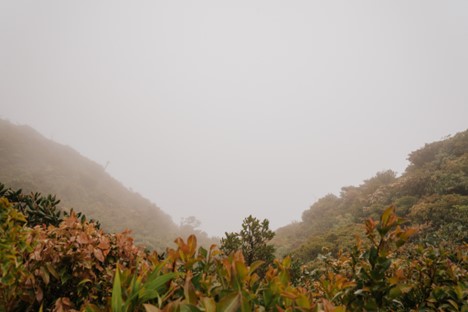
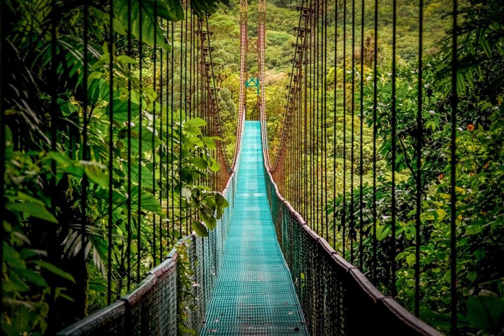
The Sendero Bosque Nuboso (Cloud Forest Trail) is a popular loop trail within the Monteverde Cloud Forest Reserve in Costa Rica. This short trail takes you through the lush and misty cloud forest, with opportunities to spot a variety of wildlife including birds, monkeys, and even the elusive jaguar. The trail is well-maintained and marked, making it accessible to hikers of all levels. Along the way, you will pass by giant tree ferns, epiphytes, and other tropical plants. The trail also offers breathtaking views of the surrounding mountains and valleys.
3. Arenal Volcano National Park – Sendero Colada 1968
- Where: Alajuela province, Costa Rica
- Starting point: Arenal Observatory Lodge or El Castillo Park entrance
- End point: 1968 trail viewpoint, overlooking the Arenal Volcano
- Time needed: 2-3 hours.
- Distance and Type: 4.5 kilometers circuit
- Difficulty: Moderate
- When to hike: Best during dry season (December to April) but can be hiked year-round.
- Where to stay: Arenal Observatory Lodge, El Castillo town, or La Fortuna town
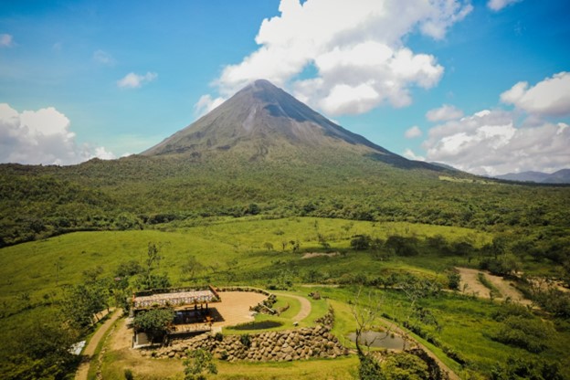
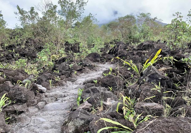
The Sendero Colada 1968 trail offers a scenic hike through the Arenal Volcano National Park, with views of the Arenal Volcano, lava fields, and lush forest. The trail is well-maintained and easy to follow, with interpretive signs providing information on the volcanic history and local flora and fauna. The hike is mostly uphill on the way to the viewpoint, with some steep sections and stairs, but offers a rewarding view of the volcano and surrounding area.
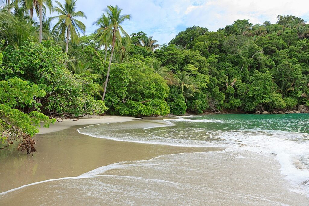
4. Manuel Antonio National Park – Sendero Perezosos
- Where: Puntarenas Province, Costa Rica
- Starting point: Main Park entrance
- End point: Loop trail ending at the main park entrance.
- Time needed: 1-2 hours.
- Distance and Type: 2 kilometers circuit
- Difficulty: Easy-Moderate
- When to hike: The park is open daily from 7:00am to 4:00pm, and it’s best to hike early in the morning to avoid crowds and heat.
- Where to stay: There are several accommodation options near the park, ranging from budget hostels to luxury hotels.
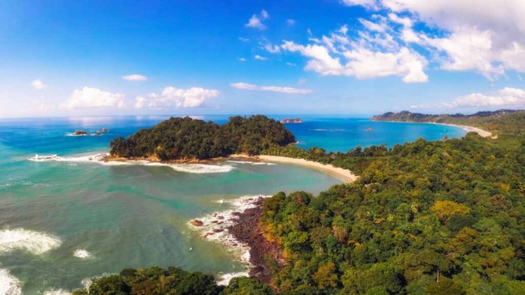
The Sendero Perezosos (Sloth Trail) is a short loop trail that takes visitors through the lush rainforest and along the coast of Manuel Antonio National Park. The trail is well-maintained and offers a chance to see a variety of wildlife, including sloths, monkeys, and tropical birds. Along the way, hikers will pass several lookout points with stunning views of the Pacific Ocean and surrounding forest. The trail is relatively easy, but there are some uphill and downhill sections that may require a bit of effort. Overall, it’s a great option for those looking for a scenic hike with plenty of opportunities for wildlife viewing.
Crossfit gym: CrossFit Quepos (located about 7 km from the park) and here is the link to their instagram: https://www.instagram.com/queposxtraining
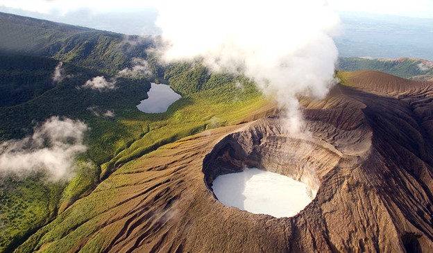
5. Rincon de la Vieja National Park – Las Pailas Loop Trail
- Where: Guanacaste Province, Costa Rica
- Starting Point: Las Pailas ranger station
- End Point: Las Pailas ranger station
- Time Needed: 2-3 hours.
- Distance and Type: 6 kilometers circuit
- Difficulty: Moderate
- When to Hike: The dry season (December to April) is the best time to hike.
- Where to Stay: There are several accommodation options near the park, including camping at Las Pailas ranger station, lodges, and hotels in the nearby town of Liberia.
The Las Pailas Loop Trail takes you through Rincon de la Vieja National Park’s active volcanic landscape. The trail starts at the Las Pailas ranger station and passes through dry forest, bubbling mud pots, steam vents, and hot springs. You’ll have the opportunity to see wildlife, such as monkeys, coatis, and various bird species. The trail is well marked and has several lookout points, including a stunning view of the Santa Maria volcano. The loop trail takes about 2-3 hours to complete, and it’s recommended to wear hiking shoes, bring plenty of water, sunscreen, and insect repellent.
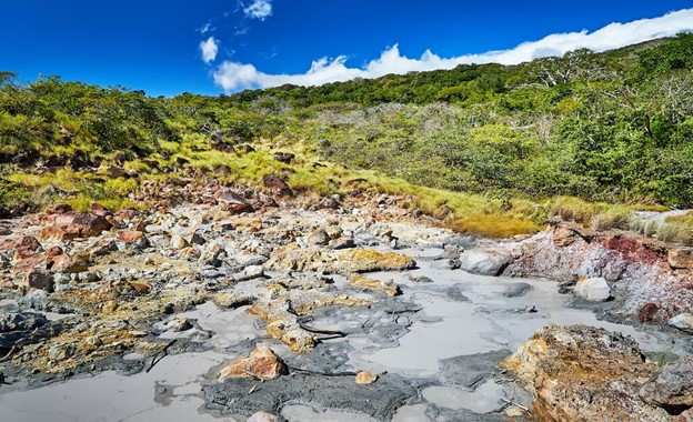
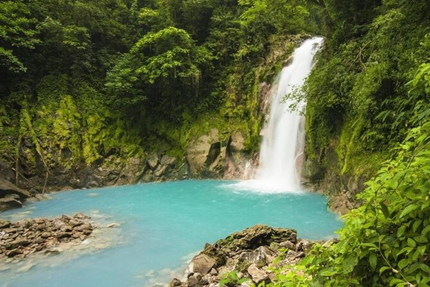
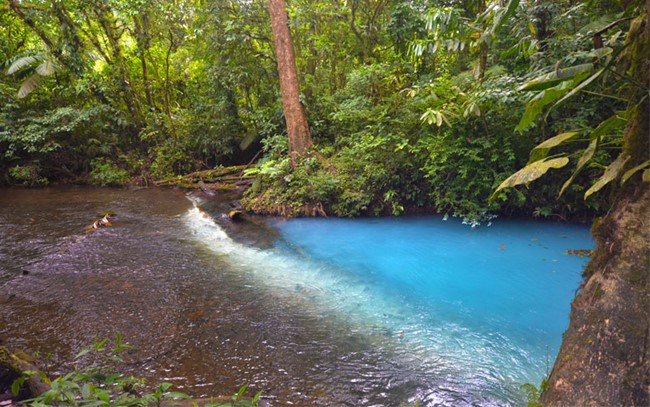
6. Tenorio Volcano National Park – Rio Celeste Trail
- Where: Guanacaste Province, northwestern Costa Rica
- Starting point: El Pilón Ranger Station
- End point: Rio Celeste waterfall and viewpoint
- Time needed: 3-4 hours.
- Distance and Type: 7 kilometer circuit
- Difficulty: Moderate
- When to hike: Dry season (December to April) is the best time to hike.
- Where to stay: There are various accommodation options in the nearby town of Bijagua, including lodges, hotels, and vacation rentals.
The Rio Celeste trail in Tenorio Volcano National Park is known for its turquoise-colored river and stunning waterfall. The trail takes you through the lush rainforest, past bubbling hot springs, and fumaroles, and across the Rio Celeste. The hike can be challenging at times due to steep inclines and rocky terrain, but the reward is well worth it when you reach the stunning Rio Celeste waterfall and viewpoint.
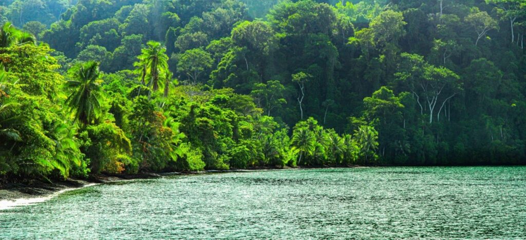
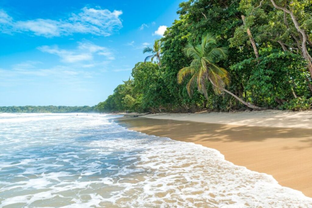
7. Cahuita National Park – Punta Cahuita Trail
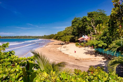
- Where: Cahuita, Limón Province, Costa Rica
- Starting Point: Cahuita National Park Entrance
- End Point: Punta Cahuita
- Time Needed: 3-4 hours.
- Distance: 8 kilometers circuit
- Difficulty: Easy
- When to Hike: Year-round
- Where to Stay: Cahuita town or nearby Puerto Viejo
The Punta Cahuita Trail in Cahuita National Park is a beautiful coastal hike that offers scenic views of the Caribbean Sea and a chance to see various wildlife, including monkeys, sloths, and tropical birds. The trail is relatively easy and suitable for all ages, with some parts being rocky and others sandy. The endpoint of the trail is Punta Cahuita, a stunning white sand beach perfect for swimming and snorkeling. The trail is well marked and can be hiked independently or with a guide.
8. Santa Rosa National Park – La Casona Trail
- Where: Guanacaste, Costa Rica
- Starting point: La Casona Ranger Station
- End point: La Casona Ranger Station
- Time needed: 1-2 hours.
- Distance: 2 kilometers circuit
- Difficulty: Easy
- When to hike: Year-round, but best during the dry season (December to April)
- Where to stay: There are several accommodations near the park, including hotels, lodges, and campsites.
The La Casona Trail is a short loop trail that takes you through the tropical dry forest of Santa Rosa National Park. Along the way, you’ll see a variety of flora and fauna, including howler monkeys, white-tailed deer, and armadillos. The trail leads to the ruins of an old hacienda, La Casona, which was destroyed during a battle between Costa Rican forces and American filibuster William Walker’s army in 1856. The trail is well-marked and easy to follow, making it a great option for families with children or anyone looking for a short, easy hike in the park.
9. Barra Honda National Park – Terciopelo Cave Trail
- Where: Nicoya Peninsula, Guanacaste Province, Costa Rica
- Starting point: Barra Honda National Park Visitor Center
- End point: Terciopelo Cave
- Time needed: 1-2 hours.
- Distance and Type: 1.5 kilometers circuit
- Difficulty: Moderate
- When to hike: Best from December to April, during the dry season
- Where to stay: There are several hotels and lodges near the national park, such as Hacienda La Pacifica and Casa Caletas Hotel Boutique.
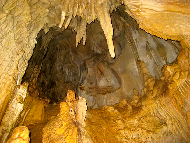
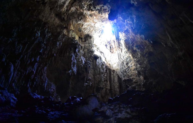
The Terciopelo Cave Trail in Barra Honda National Park takes hikers through a unique landscape of limestone formations and caverns. The trail is moderately difficult, with some steep inclines and steps to navigate. The highlight of the hike is the Terciopelo Cave, which is home to numerous bat species and an impressive variety of stalactites and stalagmites. Visitors must be accompanied by a guide to enter the cave.
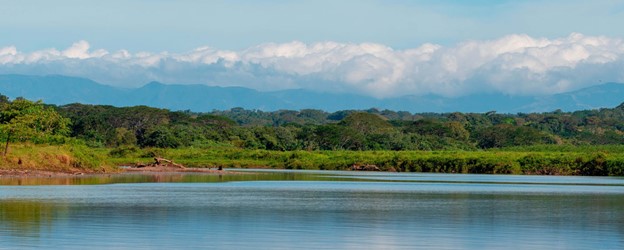
10. Carara National Park – Rio Tarcoles Trail
- Where: Carara National Park, Puntarenas Province, Costa Rica
- Starting Point: Park Entrance
- End Point: Rio Tarcoles
- Time Needed: 1-2 hours.
- Distance and Type: 2 kilometers circuit
- Difficulty: Easy
- When to Hike: Year-round, best in the dry season (December to April)
- Where to Stay: There are lodges and hotels near the park, including Cerro Lodge and Villa Lapas.
The Rio Tarcoles Trail in Carara National Park offers a short, easy hike through the lush tropical rainforest. The trail runs alongside the Tarcoles River, known for its large crocodile population, and offers scenic views of the river and surrounding forest. Visitors can also spot a variety of bird species and other wildlife along the way. The trail is well-marked and maintained, making it a popular choice for families and casual hikers.