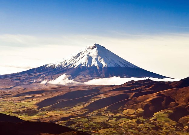
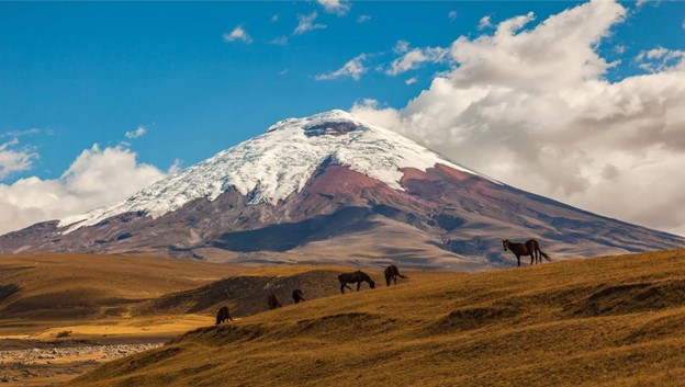
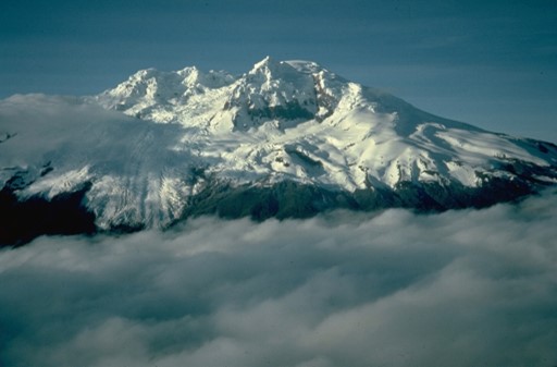
Cotopaxi National Park – Cotopaxi Summit Trail
- Where: Cotopaxi National Park, Ecuador
- Starting Point: Cotopaxi National Park entrance
- End Point: Cotopaxi summit
- Time Needed: 2 days.
- Distance and Type: 16.5 kilometers circuit
- Difficulty: Difficult
- When to Hike: May to December (best in July and August)
- Where to Stay: There are several accommodation options available in the nearby towns such as Lasso or Machachi.
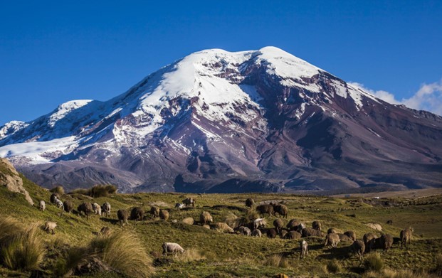
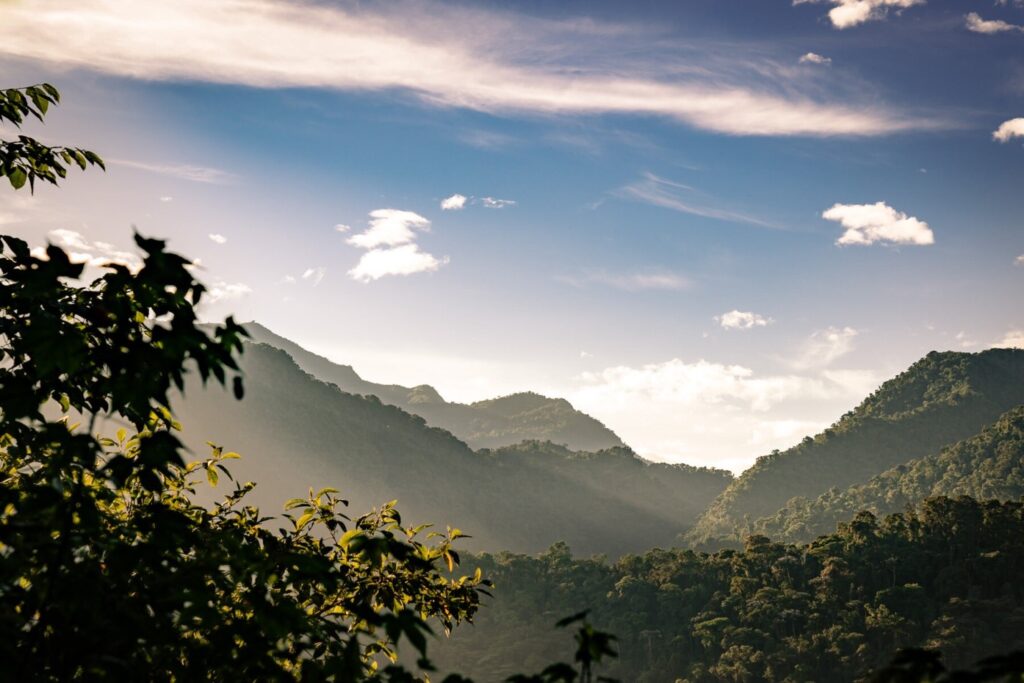
Cotopaxi National Park is home to one of the highest active volcanoes in the world, Cotopaxi. The Cotopaxi Summit Trail is a challenging hike that takes you to the top of the volcano. The trail begins at the park entrance and winds through alpine meadows and rocky terrain before reaching the snow-covered summit. Hikers must be in excellent physical condition and have experience with high-altitude trekking. Along the way, you will encounter breathtaking views of the Andes Mountains and wildlife such as wild horses, llamas, and condors.
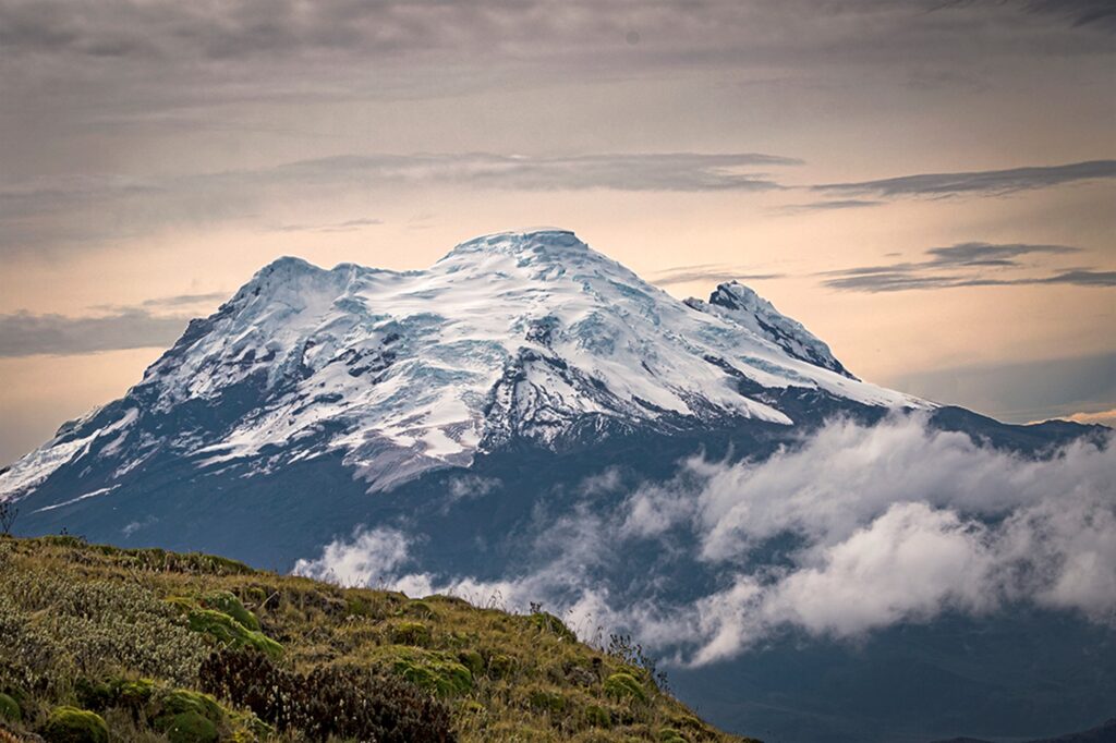
2. Chimborazo Wildlife Reserve – Whymper Summit Trail
- Where: Chimborazo Wildlife Reserve, Chimborazo, Ecuador
- Starting Point: The Edward Whymper Refuge
- End Point: The summit of Chimborazo Volcano (6,310 meters above sea level)
- Time Needed: 7-10 hours.
- Distance and Type: 6.5 kilometers circuit
- Difficulty: Difficult
- When to Hike: Best time to hike is during the dry season (June to September), as the trail can be covered in snow and ice during the rainy season (October to May)
- Where to Stay: The Edward Whymper Refuge provides basic accommodations for hikers, including beds and meals. Alternatively, there are several hotels and hostels in nearby towns such as Riobamba and Guaranda.
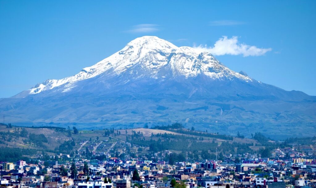
The Whymper Summit Trail is the most popular route to the summit of Chimborazo Volcano, the highest peak in Ecuador. The trail begins at the Edward Whymper Refuge and follows a steep and rocky ascent up the mountain. Hikers must be well acclimatized to the altitude and in excellent physical condition to attempt this trail. Along the way, hikers will pass through several different ecosystems, including paramo grasslands and glaciers. However, the views from the top are unparalleled, with vistas of the surrounding Andean peaks and valleys stretching out for miles in every direction.
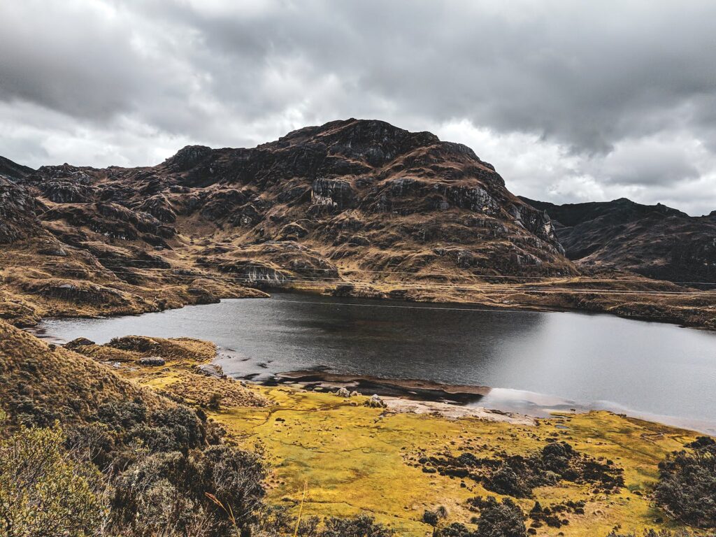
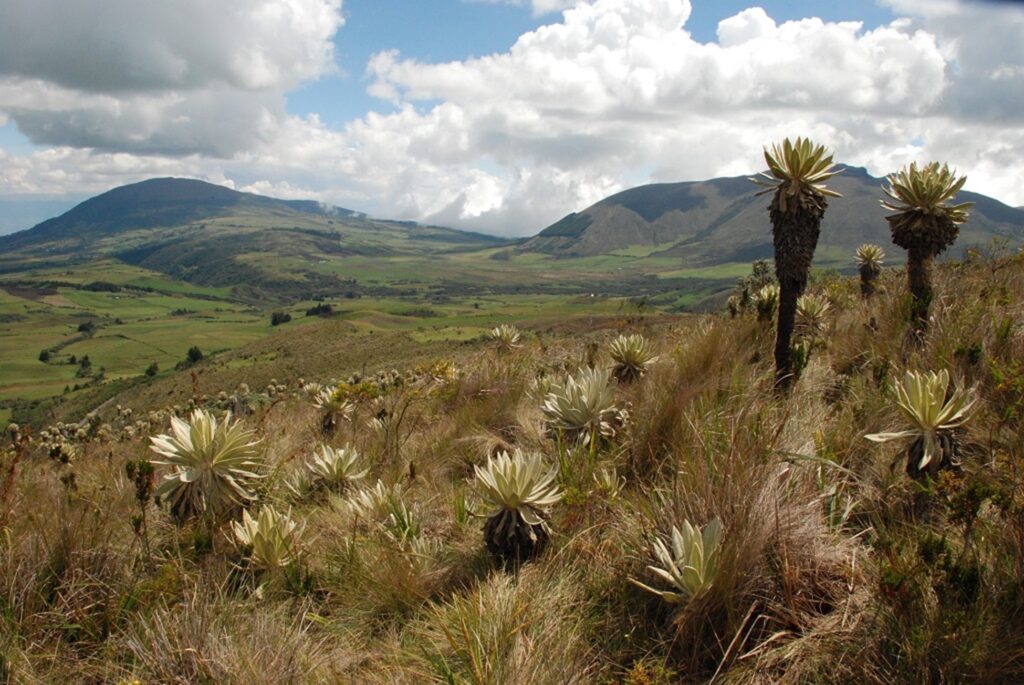
3. Cajas National Park – Toreadora Trail
- Where: Cajas National Park, Ecuador
- Starting Point: Toreadora parking lot
- End Point: Toreadora viewpoint
- Time Needed: 1-2 hours.
- Distance and Type: 3.1 kilometers circuit
- Difficulty: Moderate
- When to Hike: Year-round (best in dry season)
- Where to Stay: There are several accommodation options available in the nearby city of Cuenca.
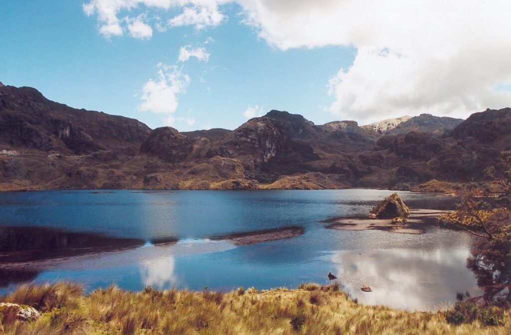
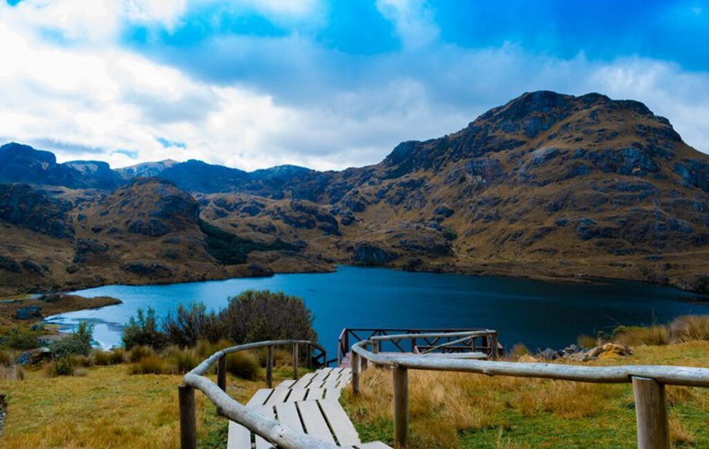
Cajas National Park is a high-altitude wilderness area located near the city of Cuenca. The Toreadora Trail is a popular hike that takes you to the top of a hill with stunning views of the surrounding lakes and mountains. The trail begins at the Toreadora parking lot and winds through the paramo landscape, characterized by high-altitude grasslands and wetlands. Hikers should be prepared for variable weather conditions and strong winds at the top. The best time to hike is during the dry season, which runs from June to September.
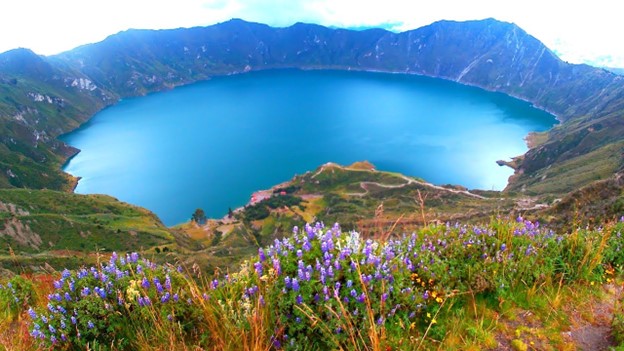
4. Quilotoa Loop – Quilotoa Crater Lake Trail
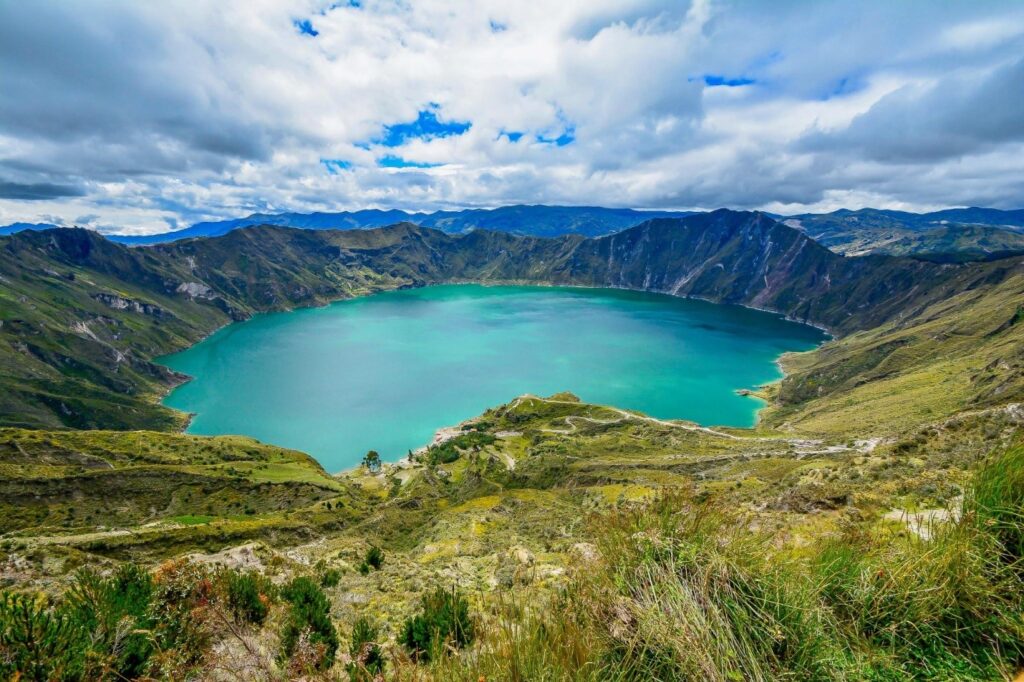
- Where: Quilotoa Loop, Ecuador
- Starting Point: Quilotoa crater rim
- End Point: Quilotoa lake shore
- Time Needed: 3-4 hours
- Distance and Type: 12 kilometers circuit
- Difficulty: Moderate-Difficult
- When to Hike: Year-round (best in dry season)
- Where to Stay: There are several accommodation options available in the nearby city of Latacunga.
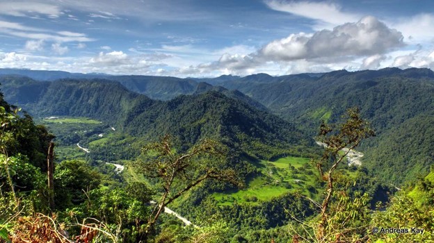
The Quilotoa Loop is a popular trekking route that takes you through remote Andean villages and stunning mountain scenery. The Quilotoa Crater Lake Trail is a highlight of the loop and takes you from the rim of the crater down to the shore of the lake. The trail is well-marked and relatively easy to follow, but hikers should be prepared for steep descents and ascents. The highlight of the hike is the turquoise colored Quilotoa Lake, which was formed by a collapsed volcano. The best time to hike is during the dry season, which runs from June to September.
5. Pasochoa Wildlife Refuge – Pasochoa Volcano Trail
- Where: Pasochoa Wildlife Refuge, Pichincha, Ecuador
- Starting Point: the entrance of Pasochoa Wildlife Refuge
- End Point: the summit of Pasochoa Volcano
- Time Needed: 3-4 hours
- Distance and Type: 7.5 kilometers circuit
- Difficulty: Moderate-Difficult
- When to Hike: Best time to hike is during the dry season (June to September), as the trail can be slippery during the rainy season (October to May)
- Where to Stay: There are several accommodation options available in nearby towns such as Machachi and Aloag, as well as camping options within the Pasochoa Wildlife Refuge
The Pasochoa Volcano Trail is a challenging hike that offers stunning views of the surrounding landscape, including the nearby Cotopaxi Volcano. The trail begins at the entrance of the Pasochoa Wildlife Refuge and follows a steep ascent up the volcano. The trail is well-marked and passes through a variety of ecosystems, including paramo grasslands and cloud forest. Along the way, hikers may encounter wildlife such as condors, llamas, and deer. The final ascent to the summit is particularly steep and requires some scrambling, but the panoramic views from the top are well worth the effort.
6. Antisana Ecological Reserve – Antisana Volcano Trail
- Where: Antisana Ecological Reserve, Pichincha, Ecuador
- Starting Point: The parking area at the entrance of the reserve.
- End Point: Mirador de la Mica viewpoint
- Time Needed: 6-8 hours.
- Distance and Type: 12 kilometers circuit
- Difficulty: Moderate to difficult due to the high altitude and steep ascent
- When to Hike: Best time to hike is during the dry season (June to September), as the trail can be muddy and slippery during the rainy season (October to May)
- Where to Stay: There are several accommodation options available in nearby towns such as Quito and Sangolquí, as well as camping options within the Antisana Ecological Reserve.
The Antisana Volcano Trail is a challenging hike that offers stunning views of the Antisana Volcano and surrounding highland landscape. The trail begins at the parking area at the entrance of the Antisana Ecological Reserve and follows a steep ascent up the volcano. The trail is well-marked and passes through a variety of ecosystems, including paramo grasslands and Andean forests. Along the way, hikers may encounter wildlife such as Andean condors, llamas, and deer. The final ascent to the Mirador de la Mica viewpoint is particularly steep and requires some scrambling, but the panoramic views from the top are well worth the effort. On a clear day, hikers can see as far as the Cotopaxi Volcano and the Pacific coast.
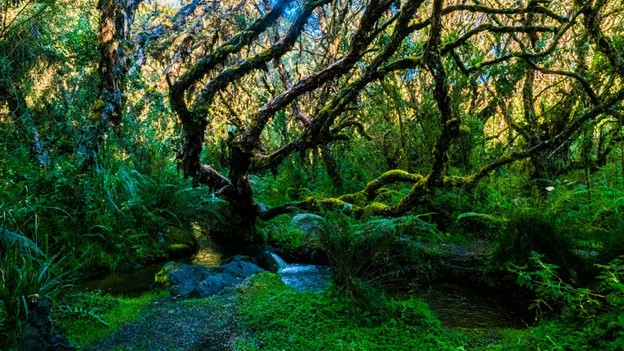
7. El Ángel Ecological Reserve – Polylepis Forest Trail
- Where: El Ángel Ecological Reserve, Carchi, Ecuador
- Starting Point: The visitor center at the entrance of the reserve.
- End Point: The Polylepis Forest
- Time Needed: 2-3 hours.
- Distance and Type: 3 kilometers circuit
- Difficulty: Easy-Moderate
- When to Hike: The trail is accessible year-round, but the best time to hike is during the dry season (June to September) when the weather is most favorable.
- Where to Stay: There are several accommodation options available in nearby towns such as Tulcán and Ibarra.
The Polylepis Forest Trail is a short but beautiful hike that takes visitors through one of the most unique ecosystems in the Andes: The Polylepis forest. This forest is characterized by its gnarled and twisted trees, which can survive in the harsh mountain environment. The trail begins at the visitor center and follows a well-maintained path through grasslands and paramo before entering the forest itself. Along the way, hikers may encounter wildlife such as rabbits, Andean foxes, and a variety of bird species. The forest is particularly beautiful in the early morning, when the mist hangs low over the hillsides and the sun illuminates the twisted branches of the Polylepis trees. Overall, this hike is a great option for those looking for a short and easy introduction to the unique natural beauty of the Andes.
8. Bellavista Cloud Forest Reserve – Bellavista Trail
- Where: Bellavista Cloud Forest Reserve, Pichincha, Ecuador
- Starting Point: the visitor center at the entrance of the reserve
- End Point: The Ridge trail
- Time Needed: 3-4 hours.
- Distance and Type: 5.6 kilometers circuit
- Difficulty: Moderate
- When to Hike: The trail is accessible year-round, but the best time to hike is during the dry season (June to September) when the weather is most favorable, and the trail is less muddy.
- Where to Stay: The Bellavista Cloud Forest Lodge is located within the reserve and offers a variety of accommodation options, including cabins and rooms in the main lodge. There are also several accommodation options in nearby towns such as Mindo.
The Bellavista Trail is a beautiful hike that takes visitors through one of the most biodiverse areas of the cloud forest. The trail begins at the visitor center and follows a well-maintained path through the forest, passing by a variety of waterfalls and streams. Along the way, hikers may encounter wildlife such as toucans, hummingbirds, and monkeys. The highlight of the trail is the ridge trail, which offers stunning views of the forest and surrounding mountains. The trail is particularly beautiful in the early morning, when the mist hangs low over the forest and the sun illuminates the canopy. Overall, this hike is a great option for those looking to experience the natural beauty and biodiversity of the cloud forest.

9. Mindo Cloud Forest Reserve – Nambillo Waterfall Trail
- Where: Mindo Cloud Forest Reserve, Pichincha, Ecuador
- Starting Point: the visitor center at the entrance of the reserve.
- End Point: Nambillo Waterfall
- Time Needed: 2-3 hours.
- Distance and Type: 3 kilometers circuit
- Difficulty: Easy-Moderate
- When to Hike: The trail is accessible year-round, but the best time to hike is during the dry season (June to September) when the weather is most favorable, and the trail is less muddy.
- Where to Stay: There are several accommodation options available in nearby towns such as Mindo and Quito.
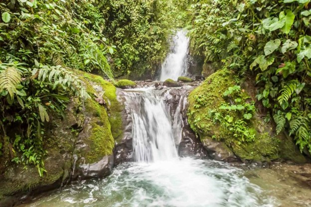
The Nambillo Waterfall Trail is a short but beautiful hike that takes visitors through the lush cloud forest of the Mindo Reserve. The trail begins at the visitor center and follows a well-maintained path through the forest, passing by a variety of flora and fauna along the way. The highlight of the trail is the Nambillo Waterfall, a picturesque waterfall that cascades down a series of rocky ledges. Visitors can take a dip in the cool waters of the pool below the waterfall, or simply relax and enjoy the scenery. The trail is particularly beautiful in the early morning, when the mist hangs low over the forest and the birdsong fills the air. Overall, this hike is a great option for those looking for a short and easy introduction to the natural beauty of the cloud forest.
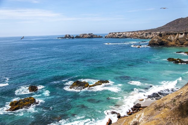
10. Isla de la Plata – Punta Machete Trail
- Where: Isla de la Plata, Coast of Manabí province, Ecuador
- Starting Point: The beach at the landing site on the island.
- End Point: Punta Machete
- Time Needed: 3-4 hours.
- Distance and Type: 6 kilometers circuit
- Difficulty: Moderate
- When to Hike: The trail is accessible year-round, but the best time to hike is during the dry season (June to September) when the weather is most favorable, and the trail is less muddy.
- Where to Stay: Visitors can stay in nearby towns such as Puerto Lopez or Manta, and take a day trip to Isla de la Plata.
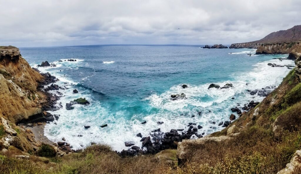
The Punta Machete Trail is a beautiful hike that takes visitors through the unique ecosystem of Isla de la Plata. The trail begins at the beach at the landing site and follows a well-maintained path through the island’s dry forest, passing by a variety of flora and fauna along the way. Visitors may encounter several species of seabirds, including blue-footed boobies and frigate birds, as well as land iguanas and other wildlife. The highlight of the trail is Punta Machete, a rocky outcrop that offers stunning views of the Pacific Ocean and the surrounding coastline. Visitors can relax and enjoy the view or explore the rocky terrain and tidal pools around the point. Overall, this hike is a great option for those looking to experience the unique natural beauty of Isla de la Plata and its wildlife.