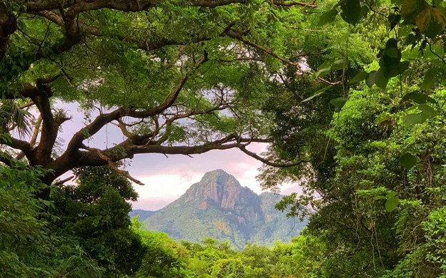
1. Mount Fuji Yoshida Trail
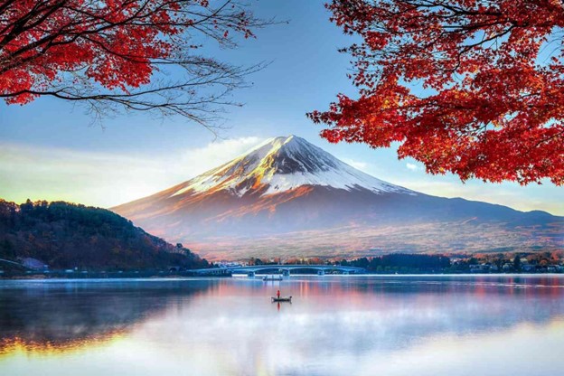
- Where: Mount Fuji, located on Honshu Island in Japan.
- Starting point: Yoshida Trailhead at 5th Station
- End point: Summit of Mount Fuji
- Time needed: 5-8 hours to reach the summit.
- Distance and Type: 14.3 kilometers circuit
- Difficulty: Difficult
- When to hike: July to early September is the official climbing season, but the trail is open from early July to mid-September.
- Where to stay: There are several mountain huts along the Yoshida Trail for overnight stays.
The Yoshida Trail is the most popular trail for hiking Mount Fuji. The trail starts at the 5th Station and passes several mountain huts and shrines along the way. The trail is well-marked, but it can be steep and rocky in some places, making it a challenging climb. The views from the summit are breathtaking, with a panoramic view of Japan’s landscape.
2. Kumano Kodo Pilgrimage Trails
- Where: Wakayama Prefecture, Japan
- Starting point: Daimonzaka Trailhead
- End point: Nachi Taisha Grand Shrine
- Time needed: 2-3 hours.
- Distance and Type: 3.5 kilometers point to point
- Difficulty: Easy-Moderate
- When to hike: Year-round, but spring and autumn offer the best weather and scenery.
- Where to stay: Ryokans (traditional Japanese inns) are available in the area.
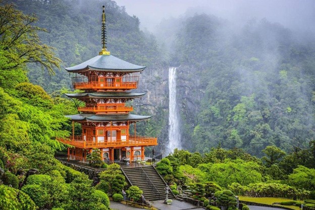
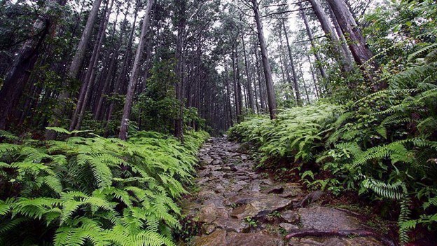
This short trail on the Kumano Kodo Pilgrimage Trails takes you through a section of the ancient route that connects various sacred sites in the Kii Mountains. The trail starts at the Daimonzaka Trailhead and leads you through a series of stone steps and moss-covered forests, passing by the Nachi Falls, one of the tallest waterfalls in Japan. The trail ends at the Nachi Taisha Grand Shrine, a UNESCO World Heritage Site and one of the three grand shrines on the Kumano Kodo. Along the way, you’ll be able to soak in the serene atmosphere of the forest and enjoy stunning views of the surrounding mountains.
3. Nakasendo Trail – Magome to Tsumago
- Where: The Nakasendo Trail is in the Kiso Valley of Japan, connecting the old post towns of Magome and Tsumago.
- Starting point: Magome
- End point: Tsumago
- Time needed: 2-3 hours.
- Distance and Type: 8 kilometers point to point
- Difficulty: Easy-Moderate
- When to hike: Year-round, but the best time to hike is from April to November when the weather is mild.
- Where to stay: There are traditional inns in both Magome and Tsumago that offer lodging to hikers.
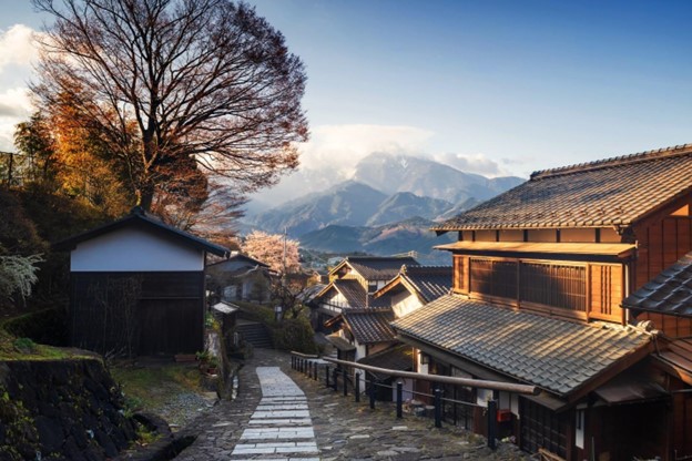
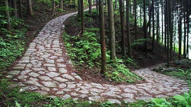
The Nakasendo Trail is a well-preserved section of the ancient highway that once connected Kyoto and Tokyo. The trail passes through charming old towns, dense forests, and scenic mountain views. The hike from Magome to Tsumago is the most popular section of the trail, with well-maintained paths and gentle slopes. Along the way, hikers can stop at small shops and restaurants to sample local food and drinks. The trail is also marked with historical markers that provide insights into the region’s history and culture.
4. Yakushima Island – Jomonsugi Trail
- Where: Yakushima Island, Kagoshima Prefecture, Japan
- Starting Point: Arakawa Trailhead
- End Point: Jomonsugi Tree
- Time Needed: 6-8 hours.
- Distance and Type: 11 kilometers circuit
- Difficulty: Moderate-Difficult
- When to Hike: Year-round, but best in spring and fall.
- Where to Stay: Accommodations available in Yakushima, including guesthouses, hostels, and hotels
The Jomonsugi Trail is a popular hiking trail in Yakushima Island that leads to the Jomonsugi Tree, one of the largest and oldest cedar trees in Japan. The trail starts at the Arakawa Trailhead and follows a well-marked path through the forest, crossing several streams along the way. The hike can be challenging at times, with steep inclines and uneven terrain, but the rewarding views and the awe-inspiring Jomonsugi Tree make it well worth the effort. The trail is open year-round, but spring and fall are the best times to hike, as the weather is mild, and the island’s flora is in full bloom.

5. Kamikochi – Kappa Bridge to Myojin Pond

- Where: Kamikochi, Nagano Prefecture, Japan
- Starting Point: Kappa Bridge
- End Point: Myojin Pond
- Time Needed: 4-5 hours.
- Distance and Type: 10 km circuit
- Difficulty: Moderate
- When to Hike: Late April to November
- Where to Stay: There are various accommodations in Kamikochi, including lodges and campsites.
The hike starts at Kappa Bridge and follows the Azusa River before ascending through forested areas to reach Myojin Pond. Along the way, hikers will enjoy beautiful views of the surrounding mountains, including the iconic Mount Hotaka. The trail is well-marked and has relatively few steep sections, making it accessible for most hikers.

6. Mount Takao – Trail #1

- Where: Mount Takao, located in Hachioji city, Tokyo, Japan
- Starting point: Takaosan-guchi Station or Kiyotaki Station on the Keio Line
- End point: Summit of Mount Takao
- Time needed: 2 hours.
- Distance and Type: 3.8 kilometers circuit
- Difficulty: Easy-Moderate
- When to hike: Year-round, but the peak season is autumn when the leaves change color.
- Where to stay: Tokyo city or nearby areas
Trail #1 is the most popular hiking trail on Mount Takao. The trail is well-marked and has several rest areas along the way. The trail leads through a lush forest, and the last stretch of the trail is a bit steep, but the view from the summit is breathtaking, and visitors can see Mount Fuji on a clear day. There are also several shops and restaurants near the summit where visitors can rest and grab a bite to eat.
7. Mount Mitake – Musashi Mitake Shrine to Mount Mitake Summit
- Where: Mount Mitake, Tokyo, Japan
- Starting Point: Musashi Mitake Shrine
- End Point: Mount Mitake Summit
- Time Needed: Approximately 1-2 hours one way
- Distance: 3 kilometers point to point
- Difficulty: Moderate
- When to Hike: Best time to hike is during spring (March to May) or autumn (September to November) for mild weather and beautiful foliage.
- Where to Stay: There are several accommodations available in the area, including traditional Japanese inns called ryokans and guesthouses.
This hike takes you through the lush forests of the Chichibu-Tama-Kai National Park and offers stunning views of the surrounding mountains. The trail is well-marked and relatively easy to follow, with a gradual incline for most of the way. Along the way, you’ll pass several smaller shrines before reaching the Musashi Mitake Shrine, a popular destination for pilgrims. From there, the trail becomes steeper and more challenging, with several sets of stairs leading to the summit of Mount Mitake. At the top, you’ll be rewarded with panoramic views of the surrounding mountains and Tokyo skyline.

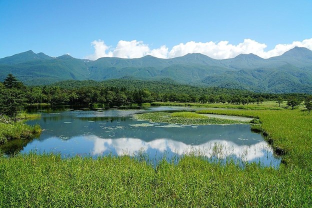
8. Shiretoko Five Lakes Hike
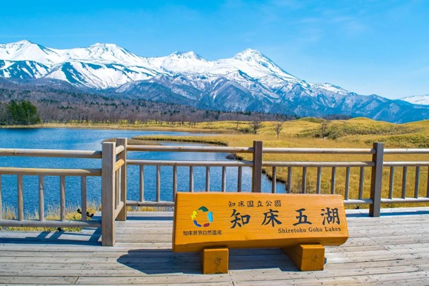
- Where: Shiretoko National Park, Hokkaido, Japan
- Starting Point: Shiretoko Five Lakes Parking Lot
- End Point: Same as starting point.
- Time Needed: 3-4 hours.
- Distance and Type: 8 kilometers circuit
- Difficulty: Moderate
- When to Hike: Late April to early November
- Where to Stay: Shari or Utoro
The Shiretoko Five Lakes Hike is a loop trail that offers beautiful views of the surrounding mountains and five interconnected lakes. The trail starts at the parking lot and passes through a forested area before reaching the first lake. Hikers can continue the trail to see all five lakes, each with its unique beauty. The trail is well-maintained and has boardwalks over wet areas. Keep an eye out for wildlife, including brown bears and deer, and make sure to bring mosquito repellent in the summer months.
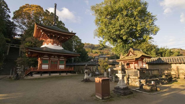
9. Mount Koya – Choishi Michi Trail

- Where: Mount Koya, Wakayama Prefecture, Japan
- Starting Point: Daimon Gate, Mount Koya
- End Point: Daimon Gate, Mount Koya
- Time Needed: 8-10 hours.
- Distance and Type: 23.5 kilometers circuit
- Difficulty: Moderate-Difficult
- When to Hike: Best time to hike is from April to November. Avoid hiking during the winter months (December to March) due to snow and ice.
- Where to Stay: There are many accommodations available in Mount Koya, including temples, guesthouses, and ryokans.
The Choishi Michi Trail is a challenging hike that takes you through the stunning forested landscape of Mount Koya. The trail starts at the Daimon Gate and passes through several Buddhist temples before reaching the summit of Mount Koya. Along the way, you will see ancient stone markers called choishi that were used by pilgrims to measure their progress. The trail is well-marked and well-maintained, but it does require a moderate level of fitness and some hiking experience. The hike can be done as a day trip from Osaka or Kyoto, or you can stay overnight in Mount Koya to explore more of the area.
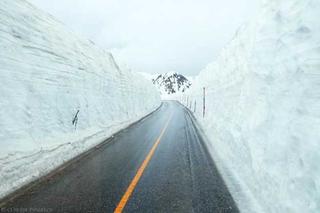
10. Tateyama Kurobe Alpine Route – Tateyama to Murodo
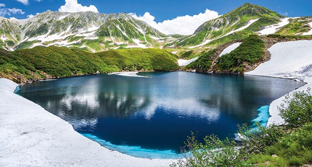
- Where: Tateyama Kurobe Alpine Route, Toyama and Nagano Prefectures, Japan
- Starting point: Tateyama Station
- End point: Murodo Station
- Time needed: 1 hour.
- Distance and Type: 3.5 kilometers point to point
- Difficulty: Easy
- When to hike: The route is open from mid-April to mid-November, and the best time to hike is from June to October.
- Where to stay: There are several lodges and accommodations along the route, including in Tateyama, Murodo, and other stops.
The Tateyama Kurobe Alpine Route is a scenic route that crosses the Northern Japan Alps. The hike from Tateyama to Murodo is relatively easy and takes about an hour, but it offers spectacular views of the surrounding mountains and the famous Snow Wall in the spring. The trail is well-maintained and passes through several tunnels and bridges, making it accessible for most hikers. Along the route, there are also several attractions such as the Kurobe Dam and the Murodo Alpine Botanical Garden.