1. Huayhuash (The Classic 8-Day Hike)
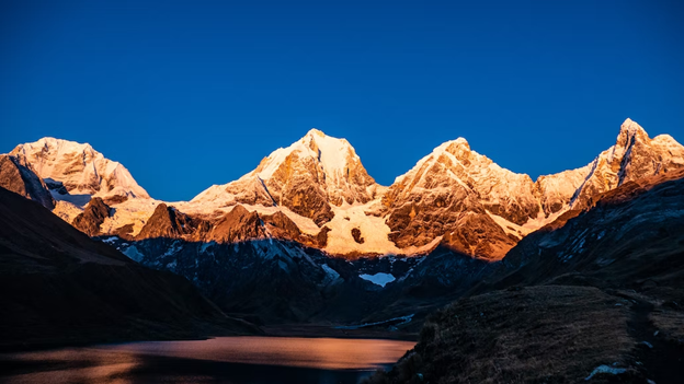
- Where: Huayhuash, located in the Andes Mountains of Peru.
- Starting Point: The town of Llamac.
- End Point: The town of Chiquián.
- Time Needed: 8 days.
- Distance and Type: Approximately 120 kilometers circuit.
- Difficulty: Difficult
- When to Hike: During the dry season, which is from May to September.
- Where to Stay: There are camping sites available throughout the route.
The Huayhuash Circuit is considered one of the most challenging treks in South America, but also one of the most rewarding. The trail takes hikers through remote Andean valleys and over high mountain passes, offering breathtaking views of towering peaks and sparkling glacial lakes. The classic 8-day route covers approximately 120 km and includes challenging ascents and descents, with elevations ranging from 3,700 to 5,000 meters. Hikers must be well-prepared for this hike, as it requires a good level of physical fitness and acclimatization to the altitude. Along the way, hikers will encounter indigenous communities, alpine meadows, and rugged mountain landscapes. The Huayhuash Circuit is a true adventure for experienced hikers seeking a challenge in a stunning wilderness setting.
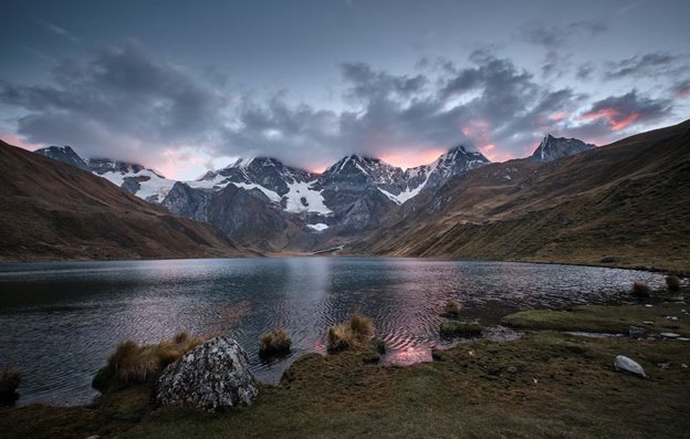
2. Santa Cruz Hike
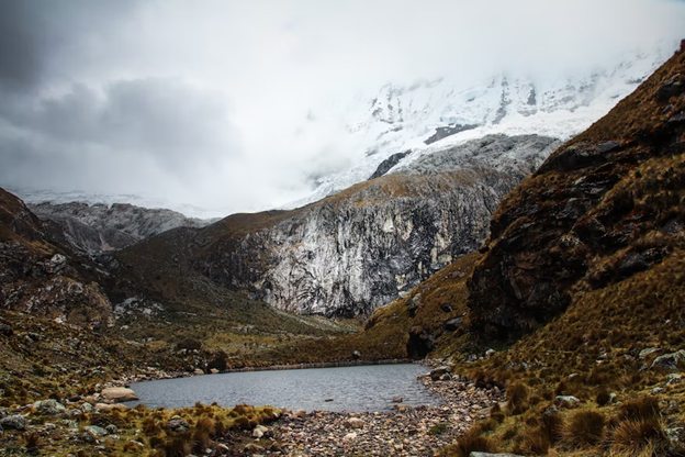
- Where: The Santa Cruz Hike is in the Cordillera Blanca Mountain range in Peru.
- Starting Point: The hike typically starts from the small town of Cashapampa.
- End Point: The hike ends in the same town of Cashapampa.
- Time Needed: The Santa Cruz Hike typically takes 4 days to complete.
- Distance and Type: The hike is about 50 kilometers point to point.
- Difficulty: Moderate
- When to Hike: The best time to hike the Santa Cruz Hike is during the dry season, which runs from May to September.
- Where to Stay: Accommodation options are limited along the trail, but there are campsites and basic refuges available.
The Santa Cruz Hike is one of the most popular hikes in the Cordillera Blanca Mountain range. The hike takes you through beautiful valleys, past crystal-clear lakes, and up to stunning mountain passes with panoramic views of snow-capped peaks. Along the way, you’ll encounter indigenous communities and can experience their culture and way of life. The hike is well-marked and does not require any technical climbing skills, but it does involve some steep ascents and descents, so a good level of fitness is recommended.
3. Inca Trail
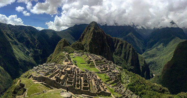
- Where: The Inca Trail is in Peru, and it is one of the most famous and popular treks in South America.
- Starting Point: The starting point for the Inca Trail is typically in the town of Ollantaytambo in the Sacred Valley of Peru.
- End Point: The trail ends at Machu Picchu, one of the most famous and impressive archaeological sites in the world.
- Time Needed: The Inca Trail is typically completed in 4 days and 3 nights.
- Distance and Type: Approximately 42 kilometers point to point.
- Difficulty: Moderate-Difficult
- When to Hike: The best time to hike the Inca Trail is during the dry season from May to September.
- Where to Stay: Hikers typically camp along the Inca Trail at designated campsites. All camping equipment and food is typically provided by tour operators.
The trail winds its way through the beautiful Andes mountains, past ancient Incan ruins, and finally arrives at the breathtaking ruins of Machu Picchu. Along the trail, hikers will pass through a variety of landscapes, including cloud forests and high mountain passes. The trail is challenging, with steep climbs and descents, but the stunning views and rich cultural history make it well worth the effort.
4. Torres Del Paine (W Route)
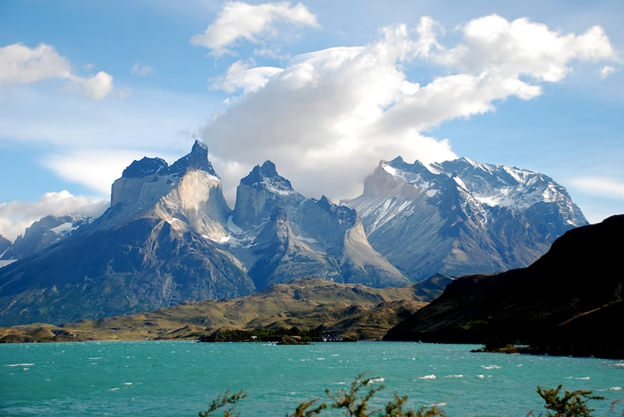
- Where: Torres del Paine National Park, Chile
- Starting Point: Refugio Las Torres
- End Point: Grey Glacier
- Time Needed: 4-5 days.
- Distance and Type: 70-80 kilometers circuit
- Difficulty: Moderate-Difficult
- When to Hike: The best time to hike the W Route is during the summer months (December to March) when the weather is mild, and the days are long. However, this is also the busiest time, so expect large crowds on the trail. Shoulder season (October to November, and April to May) can be a good option for those looking for fewer crowds, but the weather can be more unpredictable.
- Where to Stay: There are several refugios (mountain huts) and campsites along the W Route. Reservations are essential during the peak season (December to March). Some popular options include Refugio Los Cuernos, Refugio Grey, and Camping Frances.
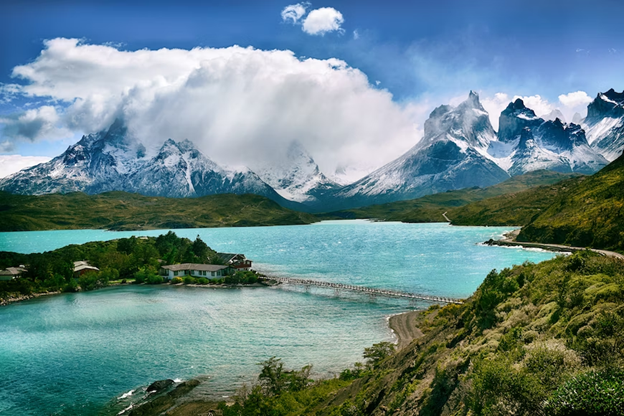
The Torres Del Paine W Route is one of the most iconic trekking routes in South America. The trail offers stunning views of the park’s granite spires, turquoise lakes, and glaciers. The trek is typically done in a counterclockwise direction, starting at Refugio Las Torres, and ending at Grey Glacier. Along the way, hikers pass through the French Valley, which is known for its breathtaking views of the surrounding mountains and glaciers. The W Route is considered moderate to challenging due to the elevation gain, rough terrain, and unpredictable weather. However, the stunning landscapes and sense of accomplishment make it well worth the effort.
5. Haute Route
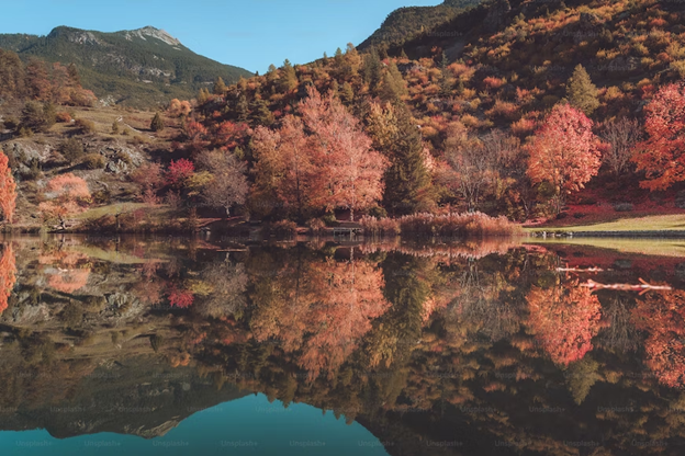
- Where: The Haute Route is a long-distance hiking trail in the Swiss and French Alps, stretching for approximately 180 km.
- Starting Point: Chamonix, France or Zermatt, Switzerland
- End Point: Zermatt, Switzerland or Chamonix, France (depending on the direction you choose to hike)
- Time Needed: The classic Haute Route typically takes 10-12 days to complete.
- Distance and Type: Approximately 180 kilometers point-to-point.
- Difficulty: Difficult
- When to Hike: The best time to hike the Haute Route is from mid-July to mid-September when the trails are typically free of snow and the weather is mild. However, hikers should be prepared for sudden changes in weather and temperature.
- Where to Stay: There are several huts and lodges along the Haute Route where hikers can stay overnight, as well as campgrounds and hotels in nearby towns.
The Haute Route is considered one of the most iconic multi-day hikes in the world, offering stunning views of the Swiss and French Alps, including the Matterhorn and Mont Blanc. The trail winds through high alpine passes, glacial valleys, and picturesque mountain villages. Hikers will encounter technical terrain, including steep ascents and descents, rocky paths, and exposed ridges. The trail also includes several high-altitude passes, including the Fenetre d’Arpette and the Col de Balme. Along the way, hikers will have the opportunity to stay in traditional Swiss mountain huts and enjoy local cuisine. The Haute Route is a challengingand rewarding hike, offering breathtaking views and a true alpine adventure.
6. Tour du Mont Blanc
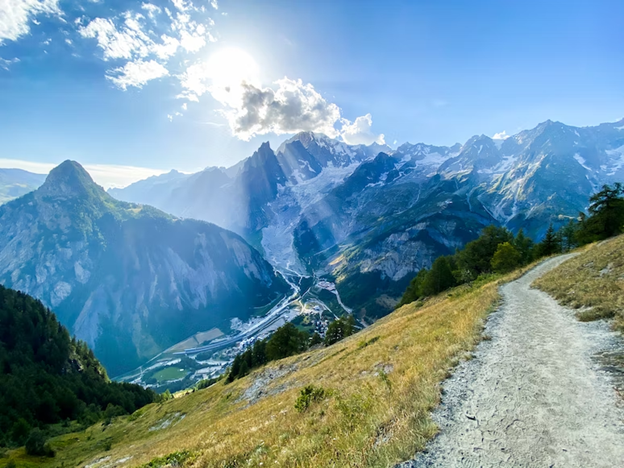
- Where: The Tour du Mont Blanc takes place in the western Alps, crossing through France, Italy, and Switzerland.
- Starting Point: The starting point of the Tour du Mont Blanc varies depending on the direction hikers choose to take. It is possible to start the trek in Les Houches or Chamonix in France, or in Courmayeur in Italy.
- End Point: The same as the starting point.
- Time Needed: The trek typically takes 7-11 days to complete, depending on the pace of the hiker.
- Distance and Type: The Tour du Mont Blanc is a 170 kilometers circuit.
- Difficulty: Moderate
- When to Hike: The best time to hike the Tour du Mont Blanc is from June to September, when the weather is generally good, and the trail is free of snow. However, it is important to note that weather conditions in the Alps can be unpredictable and hikers should always be prepared for sudden changes.
- Where to Stay: The Tour du Mont Blanc has numerous accommodation options along the way, ranging from mountain huts to hotels and guesthouses. It is recommended to book accommodation in advance during the peak hiking season.
The Tour du Mont Blanc takes hikers through stunning alpine scenery, with panoramic views of snow-capped peaks, glaciers, and alpine meadows. The trek passes through picturesque villages and towns, providing a glimpse into local alpine culture and cuisine. The route includes challenging climbs, steep descents, and rugged mountain terrain, but the stunning vistas and unique cultural experiences make the trek well worth the effort. Overall, the Tour du Mont Blanc is a must-do trek for any avid hiker or lover of the outdoors.
7. Annapurna Circuit Trek
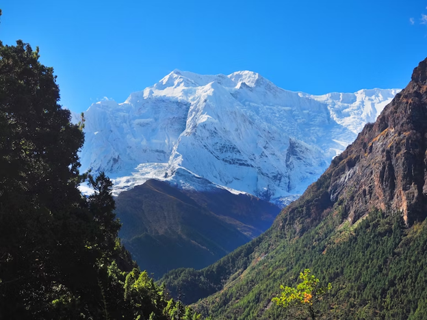
- Where: The Annapurna Circuit Trek is in the Annapurna region of Nepal.
- Starting Point: The starting point of the trek is usually in Besishahar.
- End Point: The trek ends in Nayapul or Jomsom, depending on the route taken.
- Time Needed: The trek can take anywhere from 15 to 21 days, depending on the route taken and pace of the trekker.
- Distance and Type: The trek is approximately 160-230 kilometers circuit.
- Difficulty: Moderate
- When to Hike: The best time to hike the Annapurna Circuit Trek is during the spring (March to May) and autumn (September to November) seasons when the weather is clear and dry.
- Where to Stay: Accommodation is available in local teahouses along the route. Some popular stops include Manang, Thorong Phedi, and Muktinath.
The Annapurna Circuit Trek takes hikers through a diverse range of landscapes, including lush subtropical forests, arid deserts, and high mountain passes. Along the way, hikers are treated to stunning views of the Annapurna Mountain range, including Annapurna I, II, III, and IV, as well as other peaks such as Dhaulagiri and Machhapuchhre. The trek also takes hikers through several traditional Nepalese villages, where they can experience local culture and cuisine. The highlight of the trek is the challenging climb over the Thorong La Pass, which sits at an altitude of 5,416 meters.
8. The Camino de Santiago
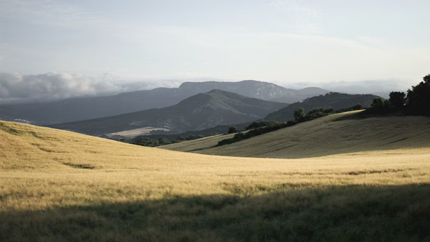
- Where: The Camino de Santiago is a network of pilgrimage routes that converge on the city of Santiago de Compostela, located in the northwest region of Spain, in the province of Galicia.
- Starting point: The starting point of the Camino de Santiago can vary depending on which route you choose, but the most popular route, the Camino Francés, starts in the French town of Saint-Jean-Pied-de-Port.
- End point: The end point of the Camino de Santiago is the Cathedral of Santiago de Compostela in Spain.
- Time needed: The time needed to complete the Camino de Santiago depends on the route you choose and how fast you walk. The Camino Francés, which is the most popular route, takes around 30-35 days to complete, while other routes can take anywhere from a few days to a few weeks.
- Distance and Type: The Camino Francés is approximately 780 kilometers point to point, while other routes vary in length. The Camino de Santiago is a pilgrimage route that can be completed on foot, by bike, or on horseback.
- Difficulty: Moderate-Difficult
- When to Hike: The best time to hike the Camino de Santiago is typically from late spring to early fall (May to September). The weather during this time is usually mild and the trails are less likely to be snow-covered.
- Where to Stay: There are a variety of accommodation options along the Camino de Santiago, including hostels, hotels, and campsites. Many pilgrims choose to stay in albergues, which are basic hostels that cater specifically to pilgrims.
The Camino de Santiago is a historic pilgrimage route that has been traveled for over 1,000 years. It is known for its beautiful scenery, rich cultural heritage, and the unique sense of camaraderie that develops among pilgrims. The route passes through diverse landscapes, including forests, mountains, and vineyards, as well as historic towns and villages. Along the way, pilgrims can visit ancient churches, monasteries, and other religious sites, and can participate in various rituals and traditions that have been a part of the Camino for centuries. Overall, the Camino de Santiago is a challenging and rewarding journey that attracts pilgrims from all over the world.
9. Pacific Crest Trail
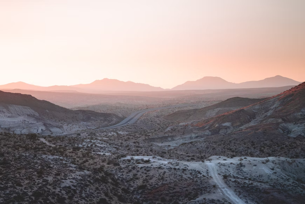
- Where: The Pacific Crest Trail (PCT) is a long-distance hiking trail that stretches from the border of Mexico and California to the border of Washington and Canada.
- Starting point: The starting point of the PCT is at the southern terminus on the border of California and Mexico.
- End point: The end point of the PCT is at the northern terminus on the border of Washington and Canada.
- Time needed: It typically takes between 4-6 months to hike the entire PCT, but many people choose to complete shorter sections of the trail over a period of several weeks or months.
- Distance and Type: 4,265 kilometers point to point.
- Difficulty: Difficult
- When to hike: The PCT is typically hiked between late April and late September, as this is the time of year when the weather is most favorable. However, the timing may vary depending on the section of the trail.
- Where to Stay: Hikers on the PCT typically camp or stay in backcountry shelters along the trail. There are also towns and resupply points along the way where hikers can restock on food and supplies.
The Pacific Crest Trail (PCT) is one of the most iconic and challenging long-distance hiking trails in the world. The trail winds its way through some of the most stunning landscapes in the western United States, including the Mojave Desert, the Sierra Nevada mountains, and the Cascade Range. Hikers on the PCT can expect to encounter varied terrain and landscapes, from hot, arid deserts to snow-capped mountain peaks. The trail also passes through numerous wilderness areas, national parks, and forests, offering hikers the opportunity to see a diverse range of flora and fauna. The PCT is not for the faint of heart and requires significant planning and preparation, but for those willing to take on the challenge, it offers an unforgettable wilderness experience.
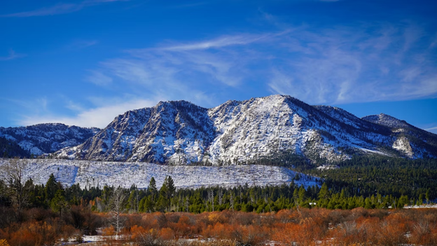
10. Rice Terraces Vietnam
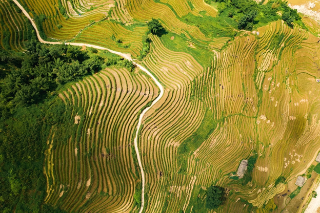
- Where: Rice Terraces, located in Northern Vietnam.
- Starting Point: The trekking usually starts from the small town of Sapa.
- End Point: The trekking usually ends back in Sapa.
- Time Needed: The time needed depends on the route taken and the pace of the trekker, but typically takes around 3-4 days.
- Distance and Type: The distance of the trek is around 30-40 kilometers point to point.
- Difficulty: Moderate-Difficult
- When to Hike: The best time to hike the Rice Terraces is from September to November, when the weather is cooler and drier.
- Where to Stay: There are several options for accommodation in Sapa, including guesthouses and hotels.
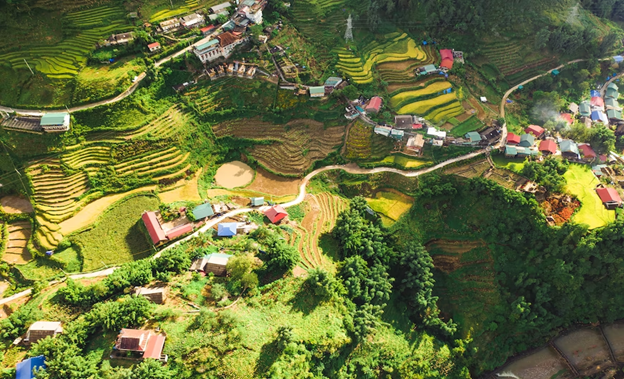
The Rice Terraces of Northern Vietnam are a stunning example of traditional farming methods and are considered a cultural heritage site. The trek takes you through villages and rice paddies, providing stunning views of the terraces and surrounding mountains. You will also interact with local ethnic minorities and experience their way of life. The trek can be challenging due to the steep terrain, but the stunning views and cultural experience make it a worthwhile adventure.
11. Kilimanjaro
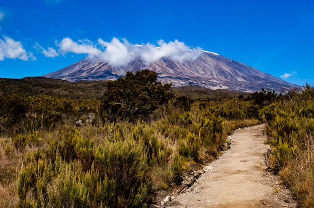
- Where: Kilimanjaro is a dormant volcanic mountain in Tanzania, Africa, and is the highest peak on the continent.
- Starting Point: The Marangu Route is the most popular route and starts at the Marangu Gate, located in the Kilimanjaro National Park.
- End Point: The summit of Kilimanjaro, Uhuru Peak, is the end point of the trek.
- Time Needed: The duration of the trek can vary depending on the route taken, but it usually takes between 5 to 9 days to complete.
- Distance and Type: The trek is approximately 70 kilometers point to point, depending on the route taken.
- Difficulty: Difficult
- When to Hike: The best time to hike Kilimanjaro is during the dry seasons from December to February and June to October. These months offer the most stable weather conditions, making it easier to climb.
- Where to Stay: Accommodation on the Kilimanjaro trek is provided in mountain huts or campsites along the route. It is important to book in advance as availability can be limited during peak seasons.
The Kilimanjaro trek is a bucket-list experience for many hikers and offers stunning views of the African landscape. The trek takes you through five different ecological zones, from lush rainforests to arctic-like conditions at the summit. The most popular Marangu route is known as the “Coca-Cola” route, due to the availability of Coca-Cola along the way. However, there are several other routes available, each with their own unique characteristics and challenges. The summit day is the most challenging part of the trek, requiring a pre-dawn start and several hours of steep ascent. However, reaching the summit and standing at the top of Africa is a truly unforgettable experience.
12. Everest Base Camp
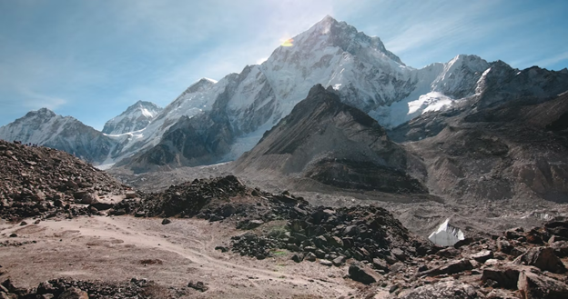
- Where: Everest Base Camp is in the Khumbu region of Nepal, near Mount Everest.
- Starting point: The starting point for the classic Everest Base Camp trek is usually Lukla, which is accessible by a short flight from Kathmandu.
- End point: The end point is the base camp of Mount Everest, at an elevation of 5,364 meters (17,598 feet).
- Time needed: The classic trek to Everest Base Camp takes about 12-14 days, depending on the itinerary and acclimatization stops.
- Distance and Type: Approximately 65 kilometers point to point.
- Difficulty: Moderate-Difficult
- When to hike: The best time to hike to Everest Base Camp is during the spring (March to May) or autumn (September to November) when the weather is generally clear and dry. Winter (December to February) is also possible but can be quite cold, while summer (June to August) is monsoon season and should be avoided.
- Where to stay: There are basic teahouses and lodges along the trail, which offer accommodation and meals. It is recommended to book ahead during the peak trekking seasons.
The trek to Everest Base Camp is a classic adventure and a once-in-a-lifetime experience for many hikers. It takes you through traditional Sherpa villages, past Buddhist monasteries, and into the heart of the Khumbu region, with spectacular views of the Himalayan peaks along the way. Along the way, hikers can experience the local culture and hospitality of the Sherpa people and witness the natural beauty of the Himalayas up close. The highlight of the trek is reaching Everest Base Camp itself, where hikers can see the world’s highest mountain towering above them.
13. Milford Track
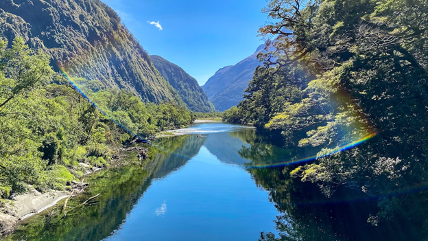
- Where: Fiordland National Park, New Zealand
- Starting point: The track starts at the northern end of Lake Te Anau, where hikers catch a boat to the track’s start at Glade Wharf.
- End point: The track ends at Sandfly Point, where hikers can take a boat to Milford Sound.
- Time needed: 4 days and 3 nights of hiking.
- Distance and Type: Approximately 53.5 kilometers point to point.
- Difficulty: Moderate
- When to hike: The best time to hike the Milford Track is from late October to late April when the weather is relatively stable.
- Where to stay: There are huts provided along the trail for overnight stays, and bookings must be made in advance.
The Milford Track is one of New Zealand’s most iconic hikes and is known as the ‘finest walk in the world.’ The track winds through stunning alpine landscapes, including crystal clear lakes, soaring peaks, and cascading waterfalls. The hike takes hikers through a variety of terrain, from dense beech forests to exposed alpine ridges, offering some of the most awe-inspiring scenery in the world. Along the way, hikers can see wildlife such as kea parrots, weka, and fiordland crested penguins. The hike also includes a crossing of the Mackinnon Pass, which provides breathtaking views of the surrounding mountains and valleys. Overall, the Milford Track is a challenging yet rewarding adventure that provides hikers with unforgettable views and a true sense of New Zealand’s natural beauty.
14. Tongariro Northern Circuit
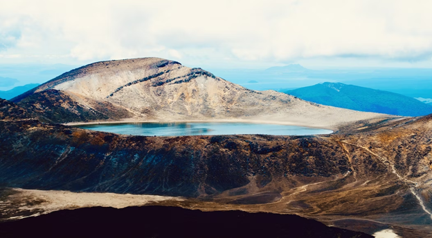
- Where: Tongariro National Park, New Zealand
- Starting point: Whakapapa Village
- End point: Whakapapa Village
- Time needed: 3-4 days.
- Distance and Type: 43.1 kilometers circuit
- Difficulty: Moderate-Difficult
- When to hike: Late October to early May (subject to weather conditions).
- Where to stay: There are four huts along the trail: Mangatepopo Hut, Oturere Hut, Waihohonu Hut, and Whakapapa Village Hut. Reservations are required and can be made through the Department of Conservation website.
The Tongariro Northern Circuit is one of New Zealand’s most popular Great Walks, taking hikers through the dramatic volcanic landscapes of Tongariro National Park. The 43.1 km loop trail starts and ends at Whakapapa Village and can be hiked clockwise or counterclockwise.The trail takes hikers past the base of Mount Ngauruhoe, which played the role of Mount Doom in the Lord of the Rings films and offers views of Mount Tongariro and the surrounding volcanic plateau. Hikers will cross stark volcanic terrain, glacial valleys, and alpine meadows, and encounter geothermal vents and steam rising from the ground. The trail includes several steep climbs and descents, including the challenging climb up to the Red Crater, which offers panoramic views of the park.
15. Banff National Park
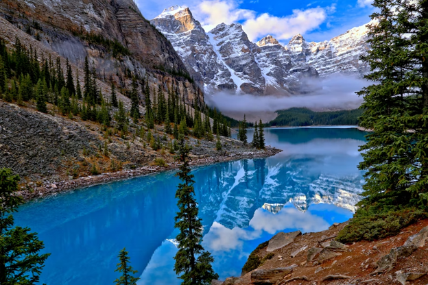
- Where: Banff National Park, Alberta, Canada
- Starting Point: Banff town
- End Point: Depends on the hike, there are many trails in the park that can be explored.
- Time Needed: Varies depending on the trail, from a few hours to several days.
- Distance and Type: Varies depending on the trail, from a few kilometers to over 100 kilometers point to point for some multi-day hikes.
- Difficulty: Easy-Difficult
- When to Hike: The best time to hike in Banff National Park is during the summer months, from June to September, when the weather is warmer, and the trails are accessible.
- Where to Stay: Banff town and the surrounding area have many accommodation options, including hotels, lodges, and campgrounds. There are also backcountry campgrounds available for those who plan to do multi-day hikes.
Banff National Park is a beautiful destination for hikers of all levels. With over 1,600 km of trails to explore, there is no shortage of options for those who want to spend time in nature. Some of the most popular trails include the Plain of Six Glaciers, Johnston Canyon, and the Sentinel Pass. For those who want a multi-day hiking adventure, there are routes like the Rockwall Trail and the Skyline Trail, which offer stunning views of the Canadian Rockies. Banff National Park also offers plenty of opportunities for wildlife viewing, with chances to see bears, elk, and moose on many of the trails.
16. Jasper National Park
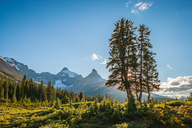
- Where: Jasper National Park, Alberta, Canada
- Starting Point: Trailhead at Maligne Lake
- End Point: Trailhead at Edith Cavell Meadows
- Time Needed: 3-5 days.
- Distance and Type: Approximately 45-50 kilometers point to point.
- Difficulty: Moderate-Difficult
- When to Hike: Late June to mid-September.
- Where to Stay: Campsites along the trail.
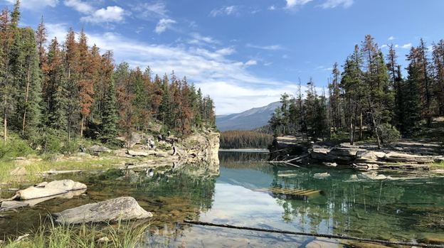
Jasper National Park is one of Canada’s most stunning outdoor destinations, and a multi-day hike is the perfect way to explore its beauty. The trail starts at Maligne Lake and winds through the rugged backcountry of the park before ending at Edith Cavell Meadows. Along the way, hikers will encounter breathtaking views of the Rockies, turquoise lakes, and stunning glaciers. The hike is challenging but rewarding, with steep ascents and descents that offer incredible views of the surrounding wilderness. Hikers will need to be prepared for variable weather conditions and should be in good physical condition. There are several campsites along the trail, including Fisherman’s Bay and the Watchtower, where hikers can rest and refuel before continuing. Overall, the Jasper multi-day hike is an unforgettable experience that offers a true taste of the Canadian wilderness.
17. The West Coast Trail
- Where: The West Coast Trail is located on the southwestern coast of Vancouver Island, British Columbia, Canada.
- Starting Point: The trail can be accessed from two points: Pachena Bay in the south and Gordon River in the north.
- End Point: The trail is a one-way hike that ends at the opposite point from where you started, either at Pachena Bay or Gordon River.
- Time Needed: The hike typically takes around 5-7 days to complete, depending on your pace and how many stops you make along the way.
- Distance and Type: Approximately 75 kilometers point to point.
- Difficulty: Difficult
- When to Hike: The West Coast Trail is open from May 1st to September 30th. The best time to hike is usually in July or August, when the weather is warm and dry.
- Where to Stay: There are several campsites along the West Coast Trail where hikers can pitch their tents. Reservations are required and can be made in advance through Parks Canada.
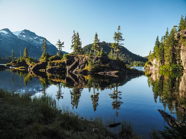
The trail winds its way through stunning coastal rainforests, sandy beaches, and rugged cliffs, offering breathtaking views of the Pacific Ocean. Hikers must navigate steep climbs, ladders, and cable car crossings, as well as unpredictable weather conditions. The trail passes by several historic sites, including old shipwrecks and First Nations villages, providing an opportunity to learn about the rich history of the area. The West Coast Trail is a true adventure and an unforgettable experience for those who dare to take on the challenge.
18. Wonderland Trail
- Where: The Wonderland Trail is in Mount Rainier National Park in the Pacific Northwest region of the United States.
- Starting point: Longmire or Sunrise
- End point: Longmire or Sunrise
- Time needed: 8-14 days.
- Distance and Type: 150 kilometers circuit
- Difficulty: Difficult
- When to Hike: July through September.
- Where to Stay: Campsites along the trail or backcountry camping with permits.
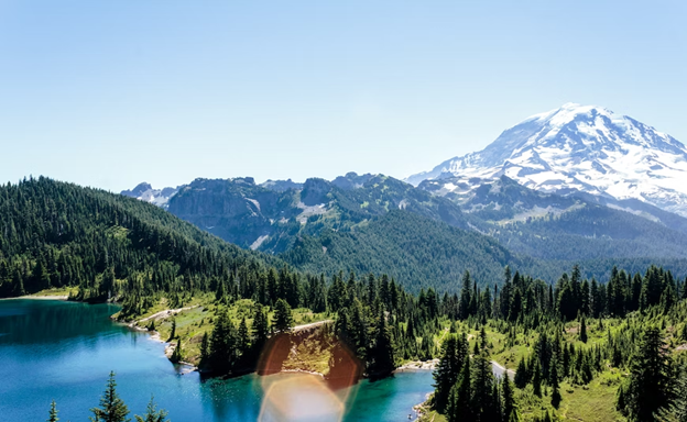
The Wonderland Trail is a challenging but rewarding trail that takes you on a 93-mile loop around Mount Rainier, the highest peak in the Cascade Range. The trail passes through stunning alpine meadows, old-growth forests, glacial rivers, and waterfalls, providing breathtaking views of the mountain and surrounding landscapes. The trail is well-marked and maintained, but hikers should be prepared for changing weather conditions and steep elevation gains. Permits are required for camping, and reservations should be made well in advance.
19. Appalachian Trail Maine
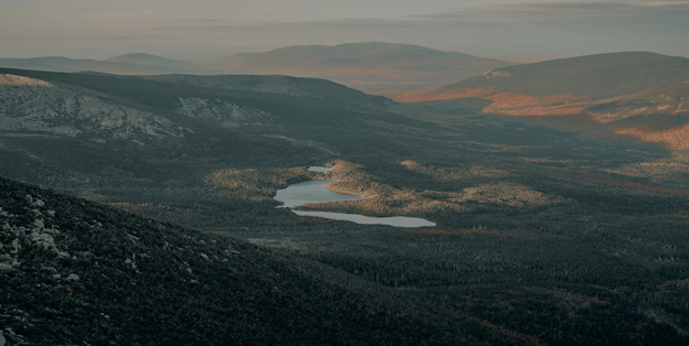
- Where: The Appalachian Trail in Maine is located in the northeastern region of the United States and spans across the state of Maine.
- Starting Point: The trail starts at the southern end of the Hundred-Mile Wilderness near Monson, Maine.
- End Point: The trail ends at the northern terminus of the Appalachian Trail at the summit of Mount Katahdin, Maine.
- Time Needed: The average time needed to complete the entire Maine section of the Appalachian Trail is approximately 10-14 days, depending on your pace and the number of stops you make along the way.
- Distance and type: The Maine section of the Appalachian Trail covers approximately 281 kilometers point to point.
- Difficulty: Difficult
- When to Hike: The best time to hike the Appalachian Trail in Maine is typically between June and September, when the weather is mild and the trails are less likely to be obstructed by snow or ice.
- Where to Stay: There are numerous backcountry campsites and shelters available along the trail, as well as several towns and hostels where hikers can restock supplies and take a break from the trail.
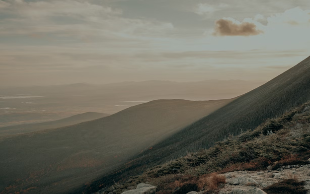
The Appalachian Trail in Maine offers hikers an incredible opportunity to explore some of the most rugged and remote wilderness areas in the northeastern United States. The trail passes through thick forests, rocky summits, and remote valleys, offering stunning panoramic views of the surrounding landscape. Along the way, hikers will encounter a variety of wildlife, from moose and bears to songbirds and other small creatures. The trail is well-marked and maintained, but hikers should be prepared for steep climbs, rocky terrain, and unpredictable weather conditions. Overall, the Maine section of the Appalachian Trail is a challenging but rewarding hiking experience that is sure to leave a lasting impression on anyone who attempts it.
20. Grossglockner High Alpine Road Trek
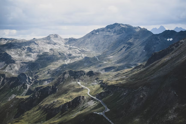
- Where: The Grossglockner High Alpine Road Trek is in the Hohe Tauern National Park in Austria.
- Starting Point: The trek starts in Heiligenblut, a small village in Carinthia.
- End Point: The trek ends in Fusch, a village in the state of Salzburg.
- Time Needed: The trek takes 5-7 days to complete, depending on the route taken and pace.
- Distance and Type: The distance of the trek is approximately 80-90 kilometers point to point, depending on the specific route taken.
- Difficulty: Moderate-Difficult
- When to Hike: The best time to hike the Grossglockner High Alpine Road Trek is from late June to early October, when the weather is more stable, and the trails are free of snow.
- Where to Stay: There are huts and lodges along the trek where hikers can stay overnight. Reservations are recommended during peak season.
The Grossglockner High Alpine Road Trek offers stunning views of the Austrian Alps, including the Grossglockner, Austria’s highest mountain. The trek takes hikers through alpine meadows, past mountain lakes, and over rocky ridges. Highlights of the trek include the Pasterze Glacier, the largest glacier in Austria, and the Edelweiss-Spitze peak, offering panoramic views of the surrounding mountains.
21. Rennsteig Trail
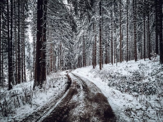
- Where: The Rennsteig Trail is in the Thuringian Forest, a mountain range in central Germany.
- Starting Point: The trail can be started in several places, but the most popular starting point is in the town of Blankenstein, which is accessible by train.
- End Point: The trail ends in the town of Hörschel, which is also accessible by train.
- Time Needed: takes around 7-10 days to complete.
- Distance and Type: 170 kilometers point to point.
- Difficulty: Moderate
- When to Hike: The best time to hike the Rennsteig Trail is from May to October.
- Where to Stay: Along the trail, there are many small towns and villages where hikers can stay in guesthouses or small hotels. There are also campsites along the trail for those who prefer to camp.
The Rennsteig Trail is one of the oldest long-distance hiking trails in Germany, running along the crest of the Thuringian Forest. The trail takes hikers through beautiful forests, meadows, and mountains, with stunning views of the landscape. The trail is well-marked and maintained, with several places to stop for food and rest along the way. The trail also passes through several small towns and villages, giving hikers a chance to experience the local culture and cuisine. Overall, the Rennsteig Trail is a challenging yet rewarding hike that offers breathtaking views and a chance to experience the natural beauty of Germany.
22. The Otter Trail
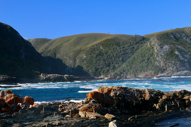
- Where: Garden Route, South Africa
- Starting Point: Storms River Mouth
- End Point: Nature’s Valley
- Time Needed: 5 days.
- Distance and Type: 42.5 kilometers point to point.
- Difficulty: Moderate-Difficult
- When to Hike: The best time to hike the Otter Trail is between March and June, and from September to November. It is closed during the months of July and August due to high rainfall and dangerous conditions.
- Where to Stay: There are overnight huts along the trail that need to be booked in advance, as well as campsites.
The Otter Trail takes hikers along the rugged coastline, through dense forests, and over steep mountains. The trail is challenging, with steep ascents and descents, river crossings, and slippery terrain. However, the stunning scenery and the opportunity to spot wildlife like baboons, otters, and dolphins make it a worthwhile experience.
23. Drakensberg Grand Traverse
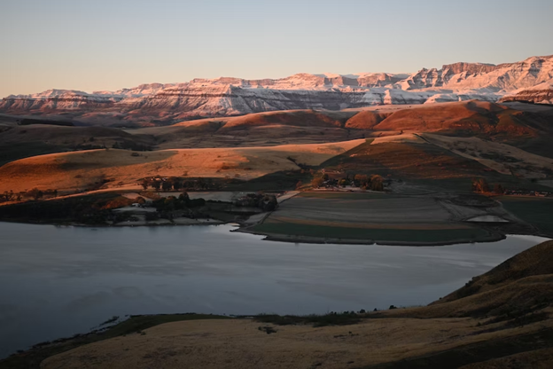
- Where: The Drakensberg Grand Traverse is a hiking trail in the Drakensberg Mountain range, located in South Africa.
- Starting Point: Sentinel Peak (near Witsieshoek Mountain Resort)
- End Point: Bushman’s Nek
- Time Needed: 9-14 days.
- Distance and Type: Approximately 220 kilometers point to point.
- Difficulty: Difficult
- When to Hike: The best time to hike the Drakensberg Grand Traverse is during the summer months of November to February when the weather is warm and dry. However, hikers should be prepared for sudden weather changes and snowfall, which can occur at any time of year.
- Where to Stay: Hikers can camp in the Drakensberg mountains or stay in one of the many lodges or resorts in the surrounding area. Some popular options include the Amphitheatre Backpackers Lodge, the Drakensberg Gardens Golf & Spa Resort, and the Cathedral Peak Hotel.
The Drakensberg Grand Traverse is considered one of the best multi-day hikes in South Africa, offering stunning panoramic views of the mountain range and the surrounding valleys. The hike follows the spine of the Drakensberg Mountains and passes through a variety of landscapes, including grassy plateaus, rocky peaks, and deep valleys. Along the way, hikers will encounter stunning waterfalls, clear mountain streams, and unique wildlife, including eland, baboons, and mountain reedbuck. The hike requires a high level of fitness and stamina, as hikers will encounter steep ascents and descents, rugged terrain, and potentially unpredictable weather conditions. However, the challenge is well worth it for those seeking an unforgettable adventure in the heart of South Africa’s natural beauty.
24. Mt. Napulauan and Mt. Amuyao Traverse
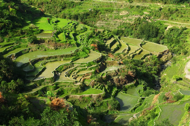
- Where: Ifugao Province, Philippines
- Starting Point: Barlig, Mountain Province
- End Point: Batad Rice Terraces, Banaue
- Time Needed: 4 days.
- Distance and Type: Approximately 40 kilometers point to point.
- Difficulty: Moderate-Difficult
- When to Hike: The best time to hike is during the dry season from February to May.
- Where to Stay: You can stay in homestays or campsites along the trail.
The hike starts in the small town of Barlig in Mountain Province and ends in the picturesque Batad Rice Terraces in Banaue. The trail takes you through lush forests, rolling hills, and steep mountain peaks, including Mt. Napulauan and Mt. Amuyao, which offers stunning views of the surrounding landscapes. Along the way, you’ll also pass by remote villages and meet friendly locals who will welcome you into their homes and offer you a taste of their traditional cuisine. The trek is moderately challenging, with some steep ascents and descents, but the incredible views and cultural experiences make it well worth the effort.
25. Quilotoa Loop
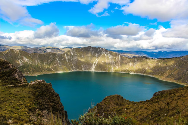
- Where: The Quilotoa Loop is in the central highlands of Ecuador.
- Starting point: The starting point is the small town of Latacunga, which is easily accessible by bus from Quito or other nearby towns.
- End point: The trek is a loop, so it ends back in Latacunga.
- Time needed: The trek can be completed in 3-5 days, depending on the route taken and the pace of the hiker.
- Distance and Type: The trek covers approximately 40-50 kilometers circuit.
- Difficulty: The Quilotoa Loop is considered a moderate to challenging trek, with high altitude and steep ascents and descents. Hikers should be in good physical condition and acclimatize properly to the altitude.
- When to hike: The best time to hike the Quilotoa Loop is during the dry season from June to September. However, the trek can be done year-round with appropriate gear and preparation.
- Where to stay: There are a variety of accommodation options along the Quilotoa Loop, including guesthouses, hostels, and camping sites. Some popular towns to stay in include Sigchos, Isinliví, and Chugchilán.
The Quilotoa Loop offers hikers a chance to experience the Andean Mountain culture and breathtaking landscapes of Ecuador. The trek takes hikers through traditional Andean villages and farmlands, with views of snow-capped mountains, lush valleys, and the stunning Quilotoa crater lake. The highlight of the trek is the turquoise-colored crater lake, which is over 3 kilometers in diameter and sits at an altitude of 3,914 meters. The Quilotoa Loop can be done independently or with a guide, and hikers should be prepared for varying weather conditions and rugged terrain.
26. Fitz Roy Trek
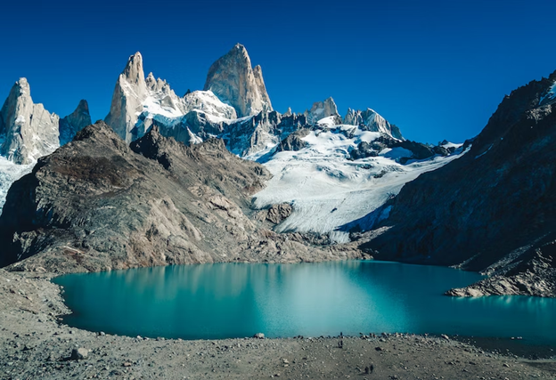
- Where: Los Glaciares National Park, Argentina
- Starting Point: El Chalten
- End Point: El Chalten
- Time Needed: 1-2 days.
- Distance and Type: Approximately 45-50 kilometers circuit.
- Difficulty: Moderate
- When to Hike: The best time to hike is from October to April when the weather is milder and there is less snow on the trail. However, be prepared for changing weather conditions and bring warm clothing as it can get cold at night.
- Where to Stay: There are campsites along the trail where you can stay overnight.
The Fitz Roy Trek is not too challenging of a hike, but does have some steep ascents and descents. The views are well worth it. You’ll see the famous Mount Fitz Roy from different angles as you hike through forests, valleys, and along rivers. The trail is well-marked and offers a variety of terrain, from rocky sections to grassy meadows. Wildlife is also abundant in the area, with chances to spot guanacos, condors, and even pumas if you’re lucky.
27. High Tatras Traverse
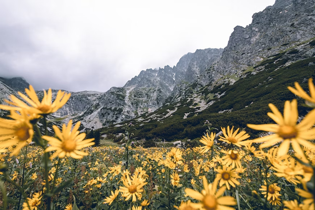
- Where: High Tatras, Slovakia
- Starting Point: Ždiar village
- End Point: Podbanské village
- Time Needed: 4-6 days.
- Distance and Type: Approximately 40-50 kilometers point to point.
- Difficulty: Moderate-Difficult
- When to Hike: The best time to hike the High Tatras Traverse is from June to September, when the weather is warm, and the trails are free of snow.
- Where to Stay: There are several mountain huts and lodges along the trail where hikers can stay overnight. Some popular options include the Chata pri Zelenom plese, the Téryho chata, and the Zamkovského chata.
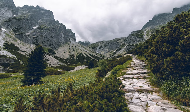
The High Tatras Traverse is a stunning multi-day hike that takes you through the rugged and beautiful High Tatras mountain range in Slovakia. The trail is well-marked and passes through alpine meadows, glacial lakes, and rocky peaks, offering breathtaking views at every turn. Highlights of the hike include the Zelene Pleso Lake, the Rysy peak, and the Skok waterfall. The trail is generally well-maintained, but some sections can be steep and challenging, requiring a good level of fitness and hiking experience. Overall, the High Tatras Traverse is a must-do for any hiker looking to experience the natural beauty of Slovakia.
28. Tatra Mountains Traverse
- Where: The Tatra Mountains Traverse is in southern Poland, near the border with Slovakia.
- Starting Point: Zakopane, a town located at the foot of the Tatra Mountains.
- End Point: The trail ends at Morskie Oko, a beautiful lake located in the Tatra Mountains.
- Time Needed: The Tatra Mountains Traverse typically takes around 5-7 days to complete, depending on your pace and the specific route you take.
- Distance: The trail covers approximately 70-80 kilometers point to point, depending on the specific route you take.
- Difficulty: Difficult
- When to Hike: The best time to hike the Tatra Mountains Traverse is from June to September, when the weather is generally milder, and the trails are clear of snow.
- Where to Stay: There are many accommodations available in Zakopane, including hotels, guesthouses, and hostels. There are also mountain huts along the trail where hikers can spend the night, although these can fill up quickly during peak season.
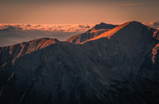
The Tatra Mountains Traverse offers some of the most spectacular scenery in Poland, with views of rugged peaks, alpine meadows, and crystal-clear mountain lakes. The trail takes hikers through some of the most remote and wild parts of the Tatra Mountains, including the highest peak in Poland, Rysy (2,499 meters). Along the way, hikers will pass through forests, pastures, and rocky ridges, as well as several mountain huts where they can rest and refuel. The trail can be challenging at times, with steep ascents and descents, but the rewards are well worth it for those who are up for the challenge.
29. BieThe Pirin Mountain Traverse
- Where: Pirin Mountains, Bulgaria
- Starting Point: Bansko
- End Point: Dobrinishte
- Time Needed: 4-5 days.
- Distance and Type: Approximately 70 kilometers point to point.
- Difficulty: Difficult
- When to Hike: The best time to hike the Pirin Mountain Traverse is from mid-June to mid-September, when the weather is mild, and the trails are clear of snow.
- Where to Stay: Camping or mountain huts along the route.
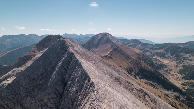
The Pirin Mountain Traverse is a challenging multi-day hike in the Pirin Mountains, located in southwestern Bulgaria. The route is approximately 70 km long and takes around 4-5 days to complete, with breathtaking views of the surrounding peaks and valleys. The hike starts in the town of Bansko and follows a series of well-marked trails and footpaths through the Pirin Mountains. Hikers will pass through alpine meadows, dense forests, and high mountain passes, as well as several glacial lakes and waterfalls. The Pirin Mountain Traverse is a difficult hike that requires a good level of fitness and experience in mountain hiking. Hikers should come prepared with appropriate gear and equipment, including sturdy hiking boots, warm clothing, and a waterproof jacket. Overall, the Pirin Mountain Traverse is an unforgettable hiking experience that offers stunning natural beauty and a challenging adventure for experienced hikers.
30. Kamnik-Savinja Alps Traverse
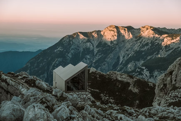
- Where: Kamnik-Savinja Alps, Slovenia
- Starting Point: Kamnik or Logarska Dolina
- End Point: Solčava
- Time Needed: 4-5 days.
- Distance and Type: Approximately 70 kilometers point to point.
- Difficulty: Moderate-Difficult
- When to Hike: The best time to hike the Kamnik-Savinja Alps Traverse is from June to September when the weather is pleasant, and the trails are not covered in snow.
- Where to Stay: There are mountain huts and guesthouses along the way where hikers can stay overnight. Some popular options include Kamniška koča na Kamniškem sedlu, Dom v Tamarju, Dom na Okrešlju, and Koča pod slapom Rinka.
The Kamnik-Savinja Alps Traverse is a stunning multi-day trek that takes hikers through the breathtaking Kamnik-Savinja Alps in northern Slovenia. The route starts in the town of Kamnik or in the beautiful Logarska Dolina valley and ends in the village of Solčava. The trek is approximately 70 km long and takes 4-5 days to complete. The trail is a mix of steep ascents, rocky paths, and exposed ridges, making it a moderate to difficult hike. However, the views from the high mountain passes and peaks make the effort worthwhile. Along the way, hikers will pass through pristine alpine meadows, dense forests, and crystal-clear streams. They will also have the opportunity to climb some of the highest peaks in the Kamnik-Savinja Alps, including Mount Grintovec, which stands at 2,558 meters. The trek is marked with red and white signs, and hikers should have a good level of fitness and experience in hiking on rough terrain. It is recommended to carry enough water and food supplies as well as appropriate gear for the weather conditions.

